
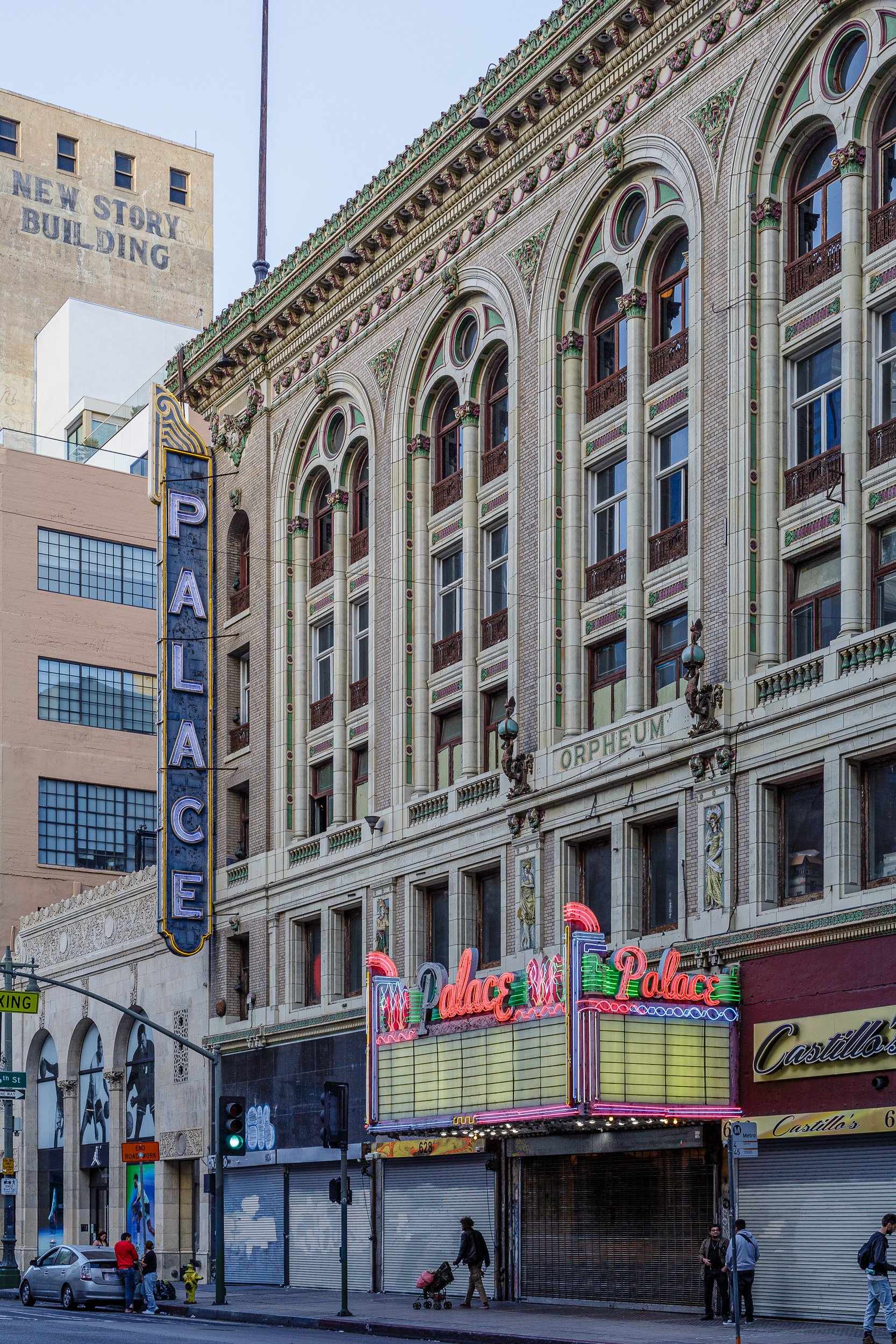
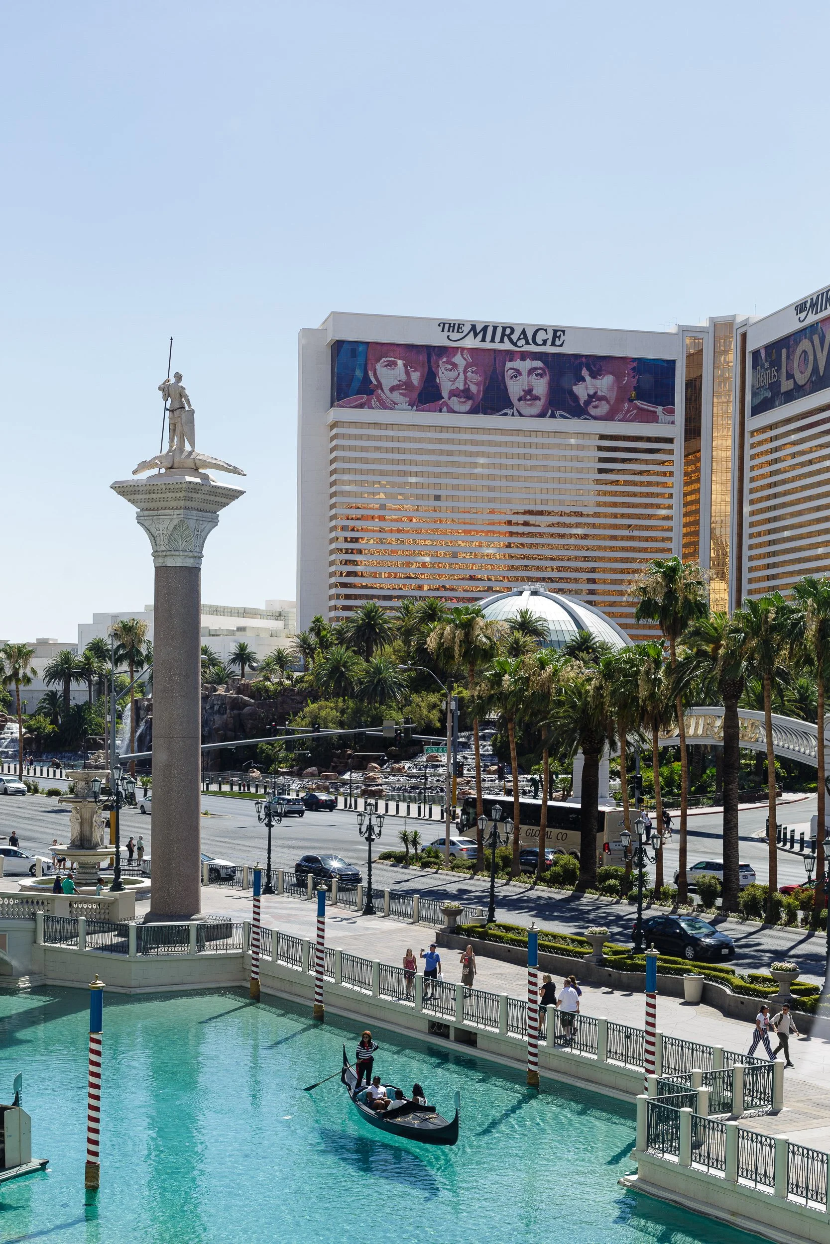
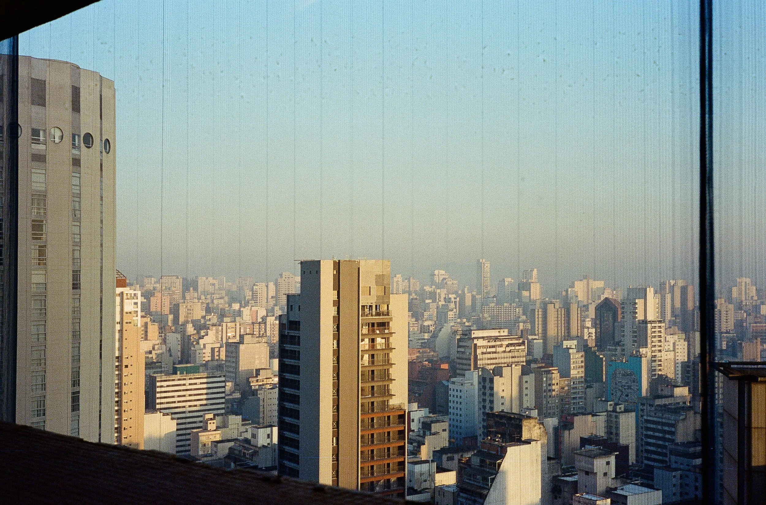
Lands divided
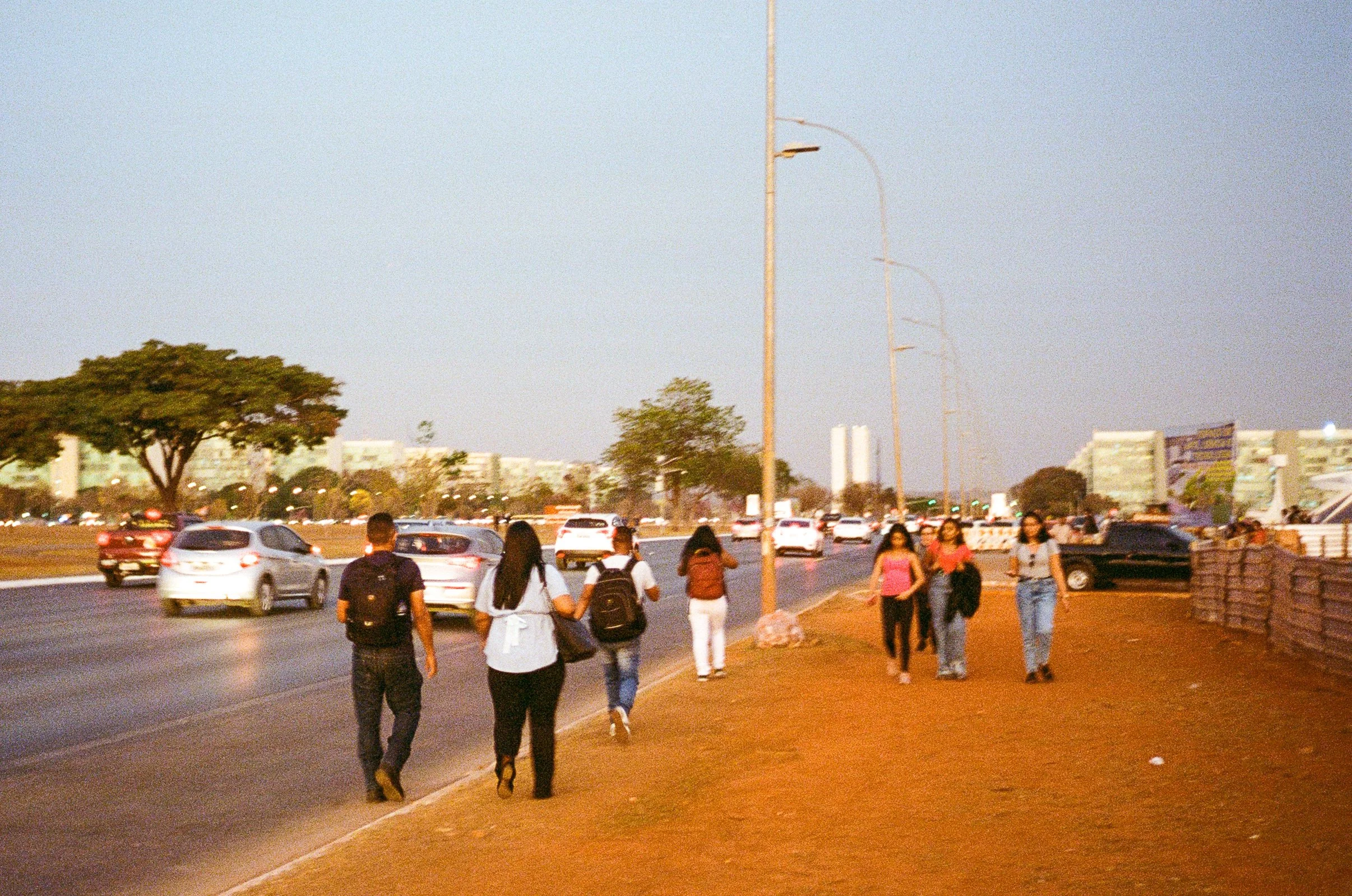
A road trip through the Divided States of America, months before the fatal 2024 election.
A road trip through the Divided States of America, months before the fatal 2024 election.


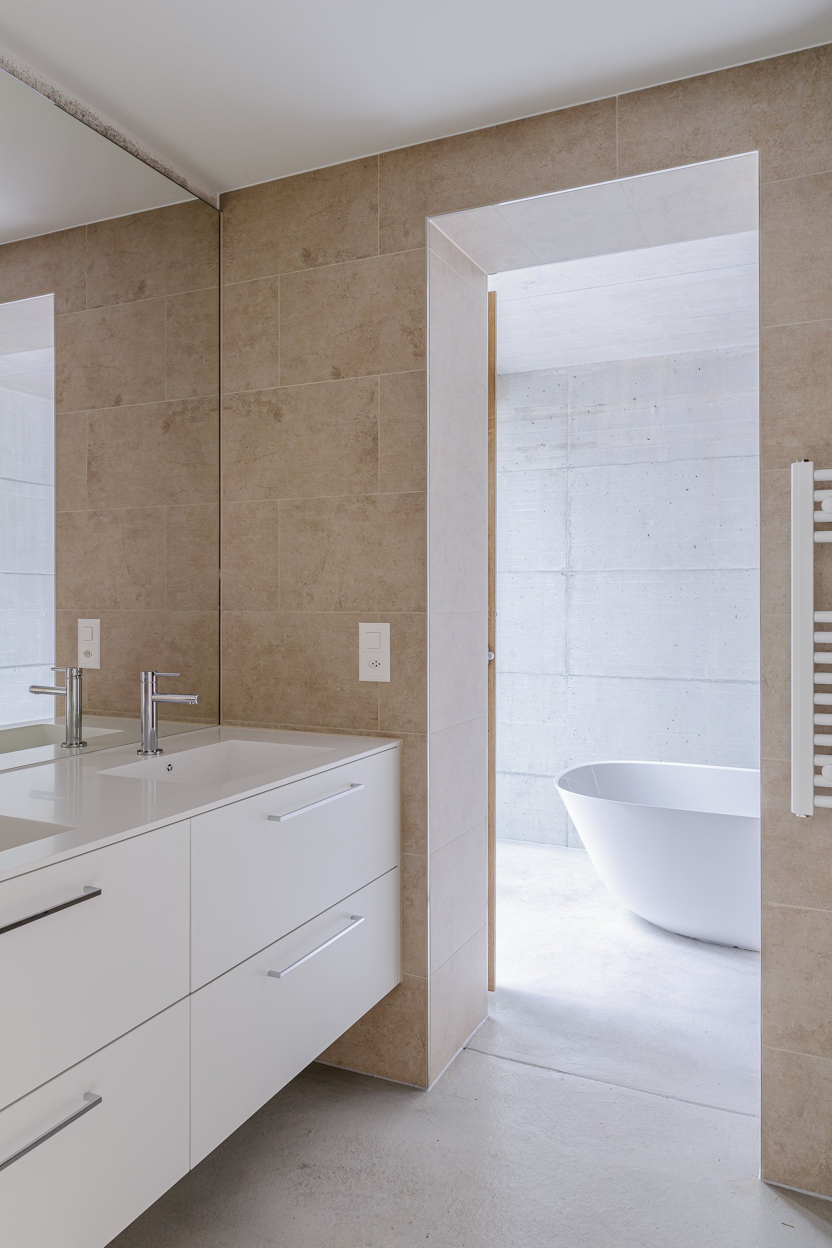
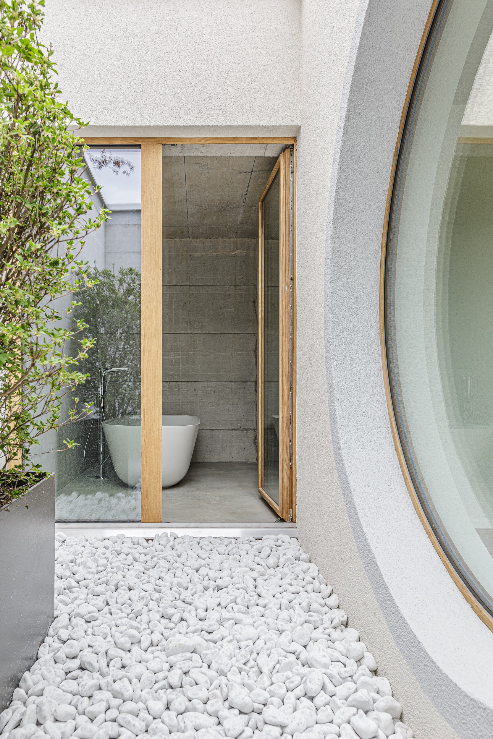
Hotel Sonnenberg
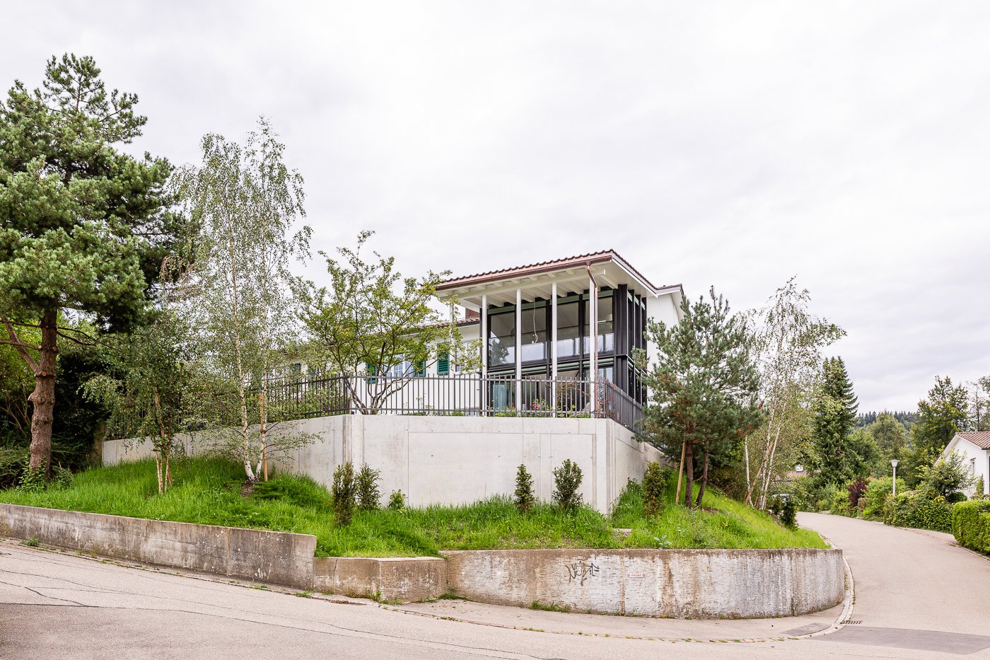
Documentation of a 19th century hotel complex that became a centre for transcendental meditation.
The hotel was opened in 1875 and extended over the years. In 1972, an Indian Yogi guru bought the hotel and turned it into an international meeting place for transcendental meditation. In November 2022, real estate developer Halter bought the building complex to return it to its initial use and densify the area with apartments. I was asked to document the buildings in their current state.


Mittelland
An installation on the urban condition of Switzerland.
Installation with video, group exhibition «Dearrival» by Spieglerey, in «Lattich» art space, 16–20 October 2017, St. Gallen.
The installation brings the urban condition of Switzerland to a very average living room. The country is an endless series of independent municipalities, each with the same autistic groups of apartment buildings, single family houses, infrastructures, and industrial areas. The drone video makes abstract planning laws visible and brings them to the home tv. The fully furnished living room with personal touches resembles any other living room. It is as interchangeable as the urban landscape it is set in.
Human Landscapes
Humans influence every square centimetre of the earth’s crust.
How do we shape our environments?
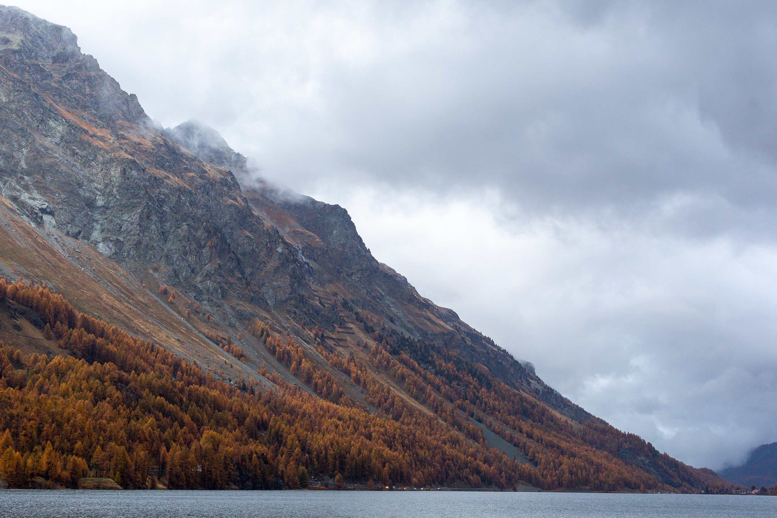


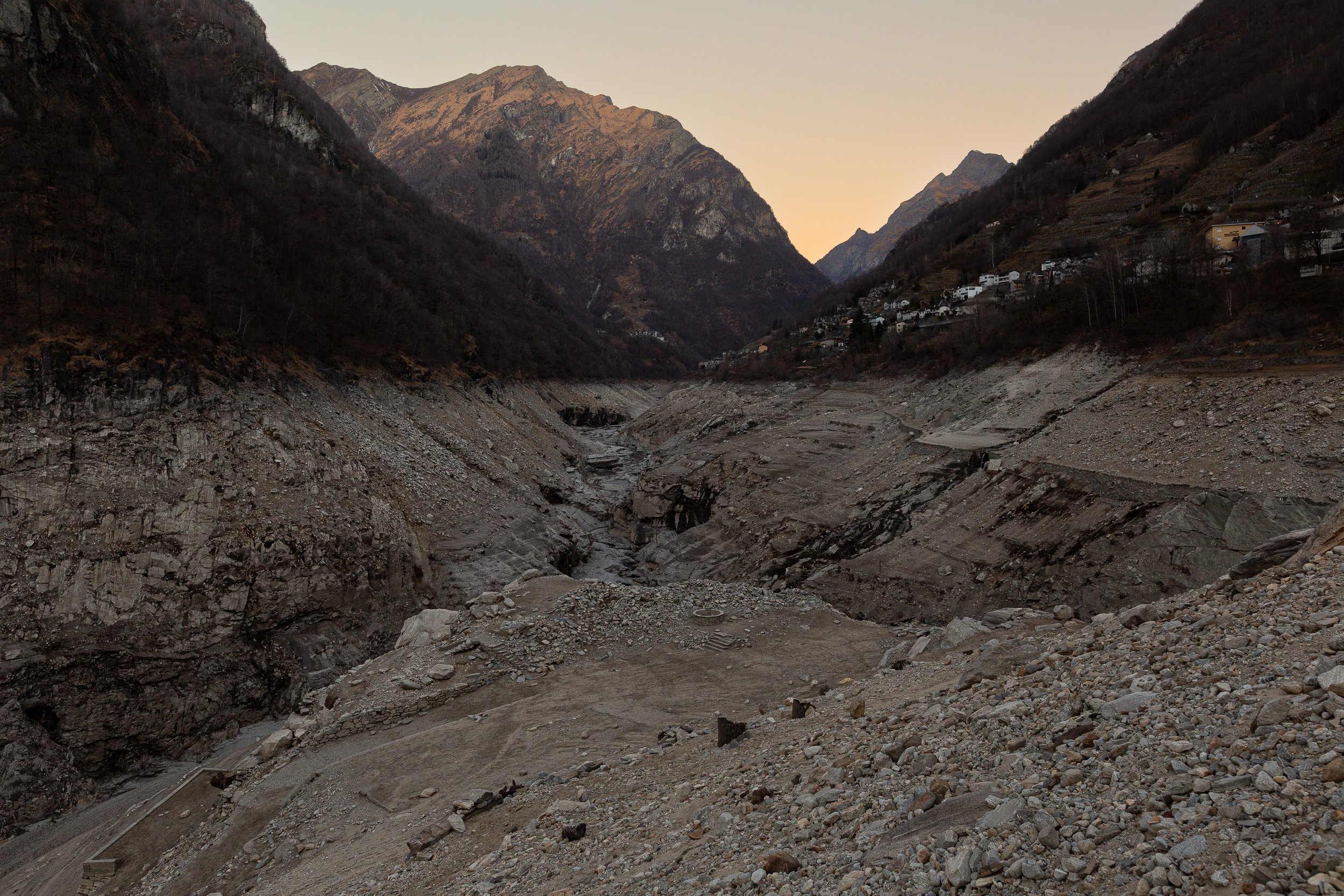
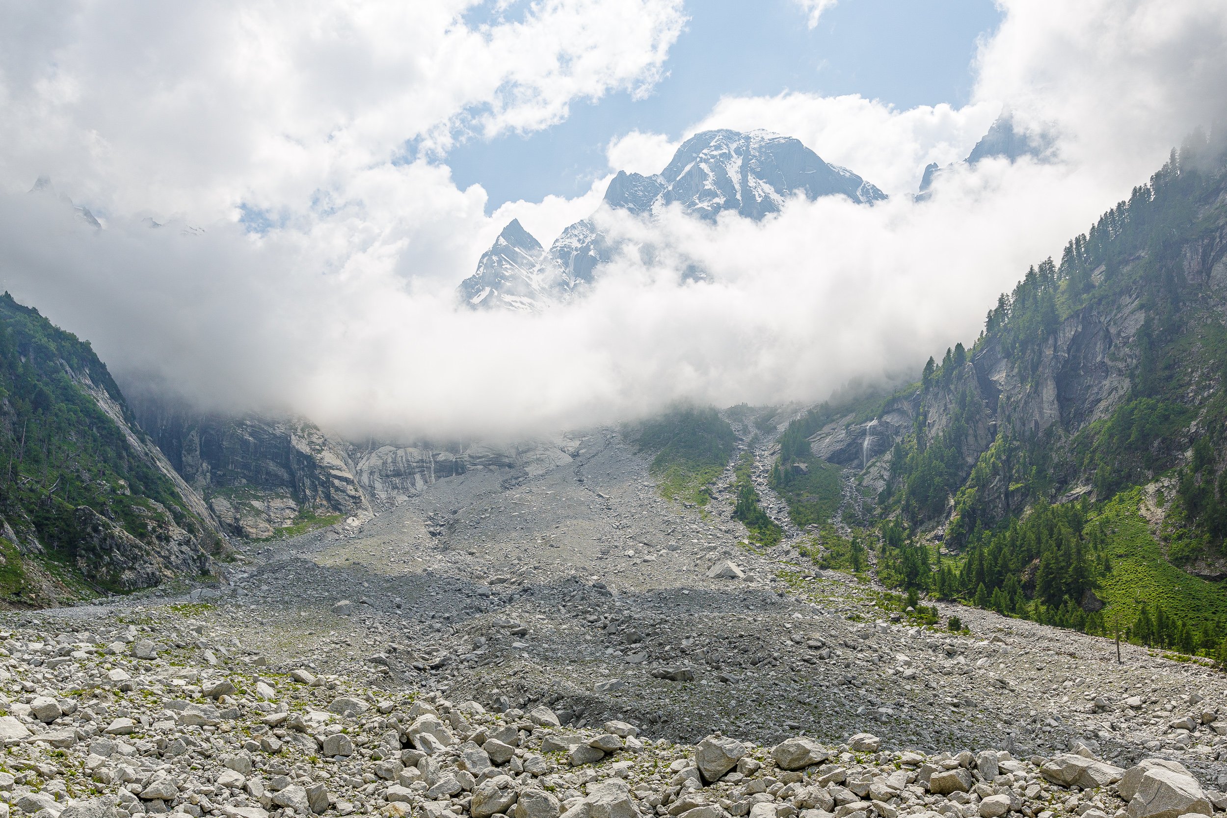
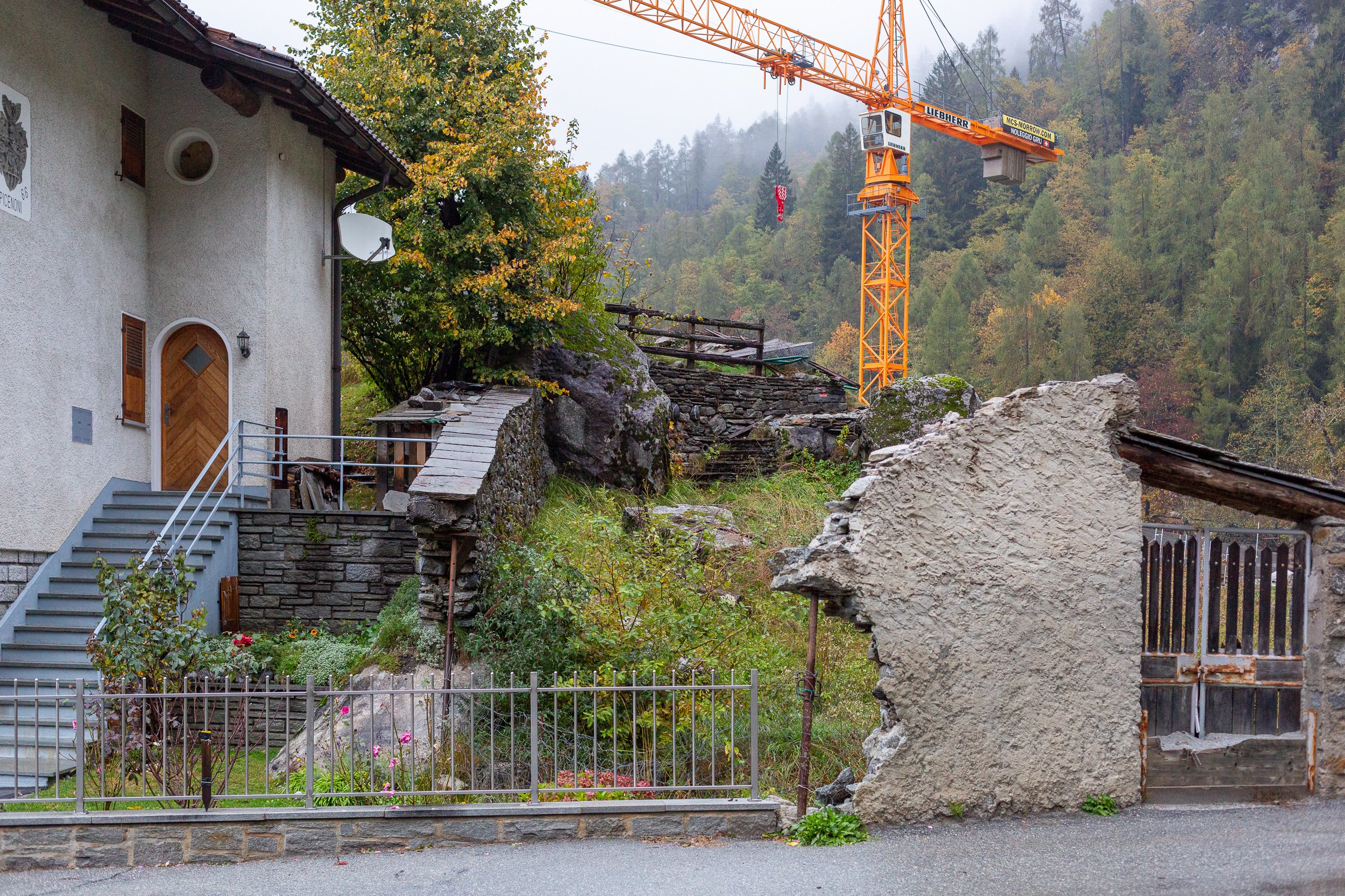
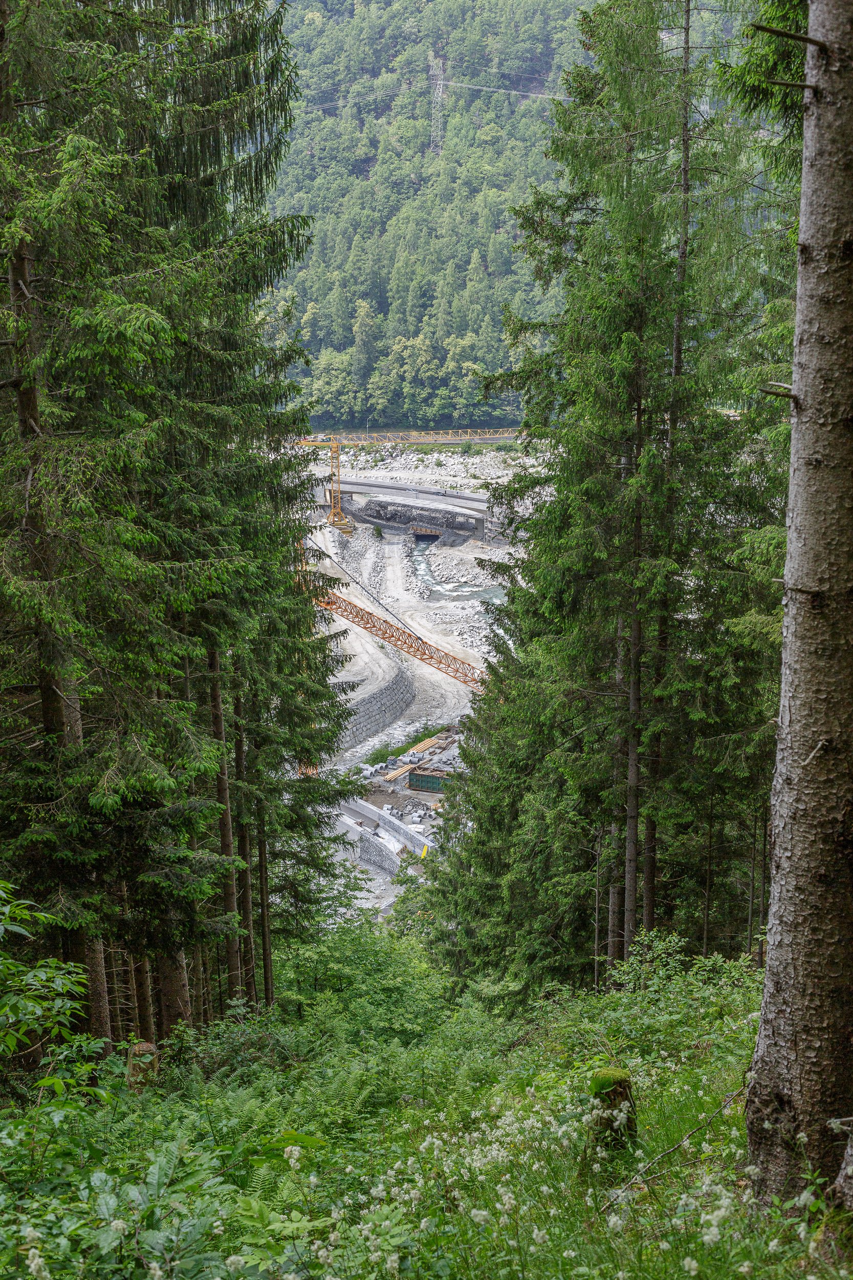
Bondasca
Thawing permafrost makes our mountains crumble.
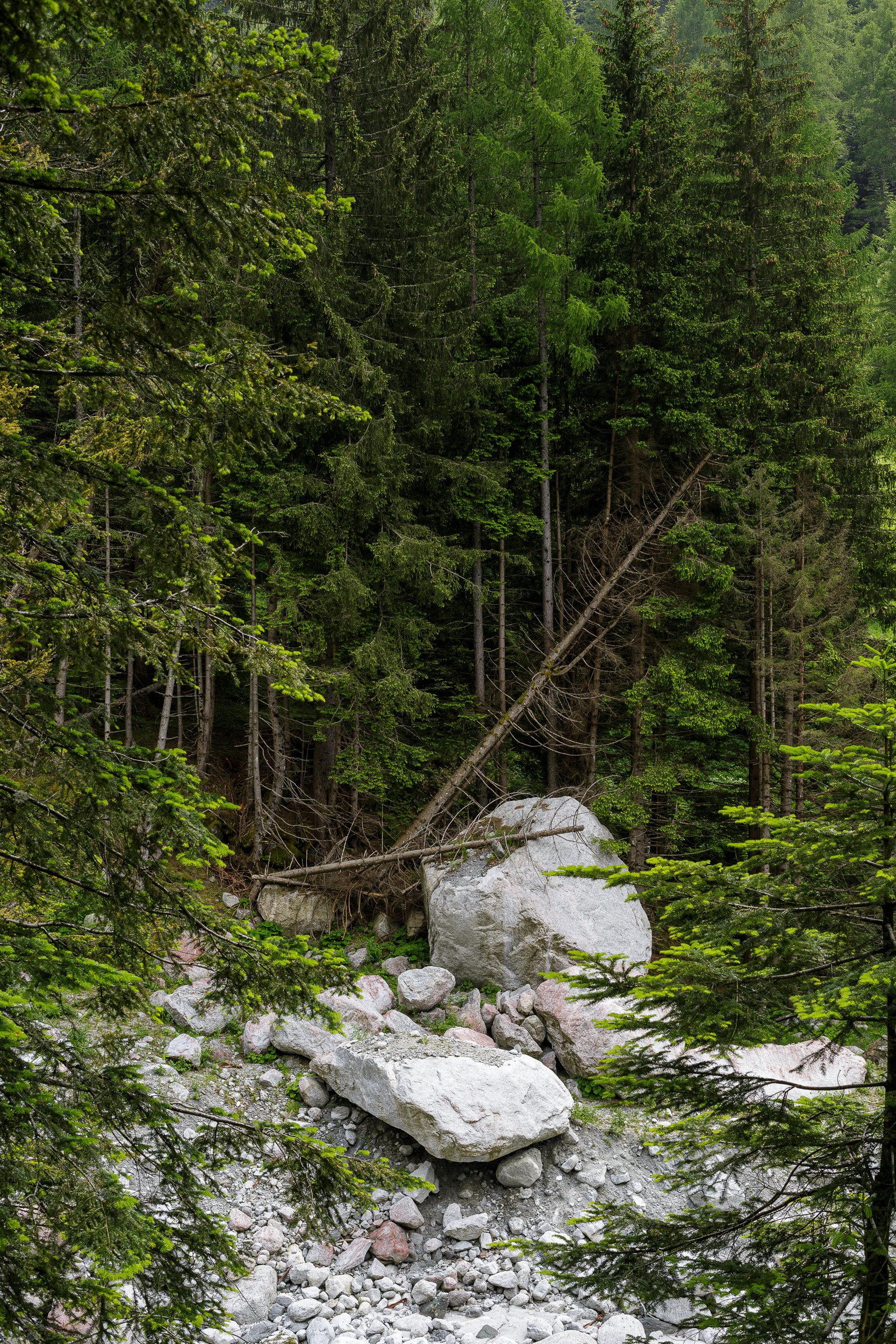
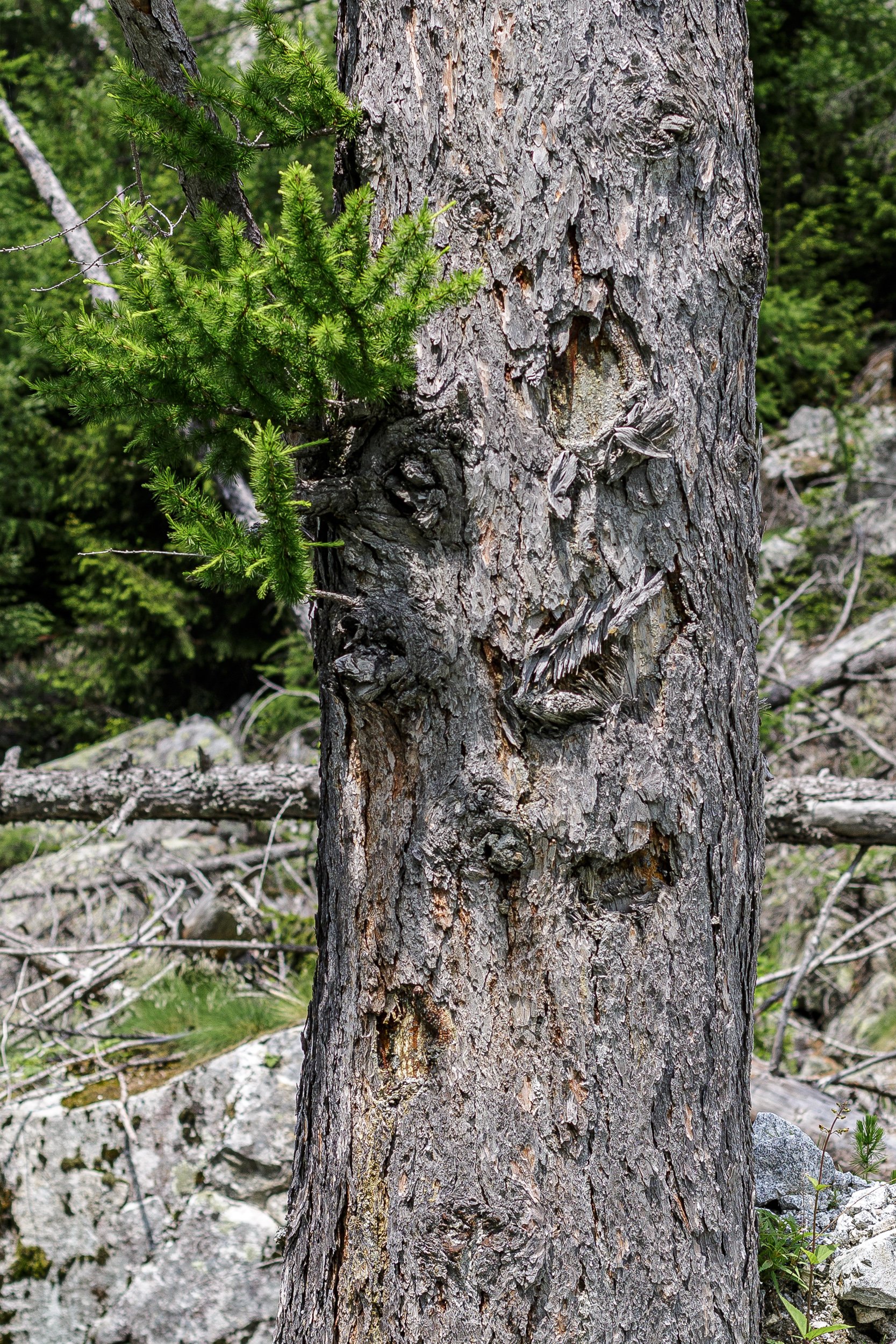
In 2012 and in 2017, a total of 5 mio. cubic metres of rock thundered down Pizzo Cengalo through the Bondasca valley. Rising temperatures make permafrost thaw – the permanently frozen water kept loose rocks together. As a result of the melting ice, our mountains are crumbling.
The first photograph was taken in 2011, the second in 2023. Since 2017, the whole valley has been closed for humans. I was curious how nature developed in the past six years without human intervention. Albeit, it must be said that the rockfalls are the result of human actions – climate change is human made.
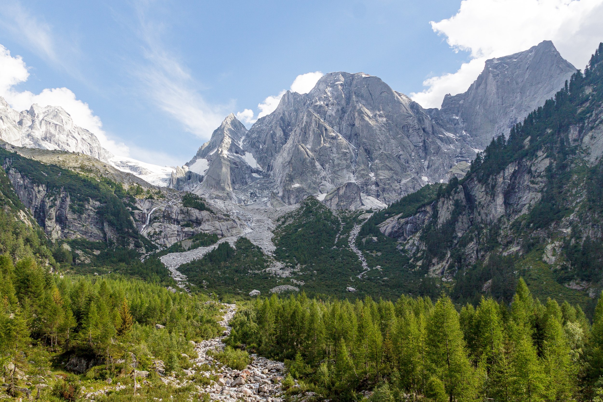
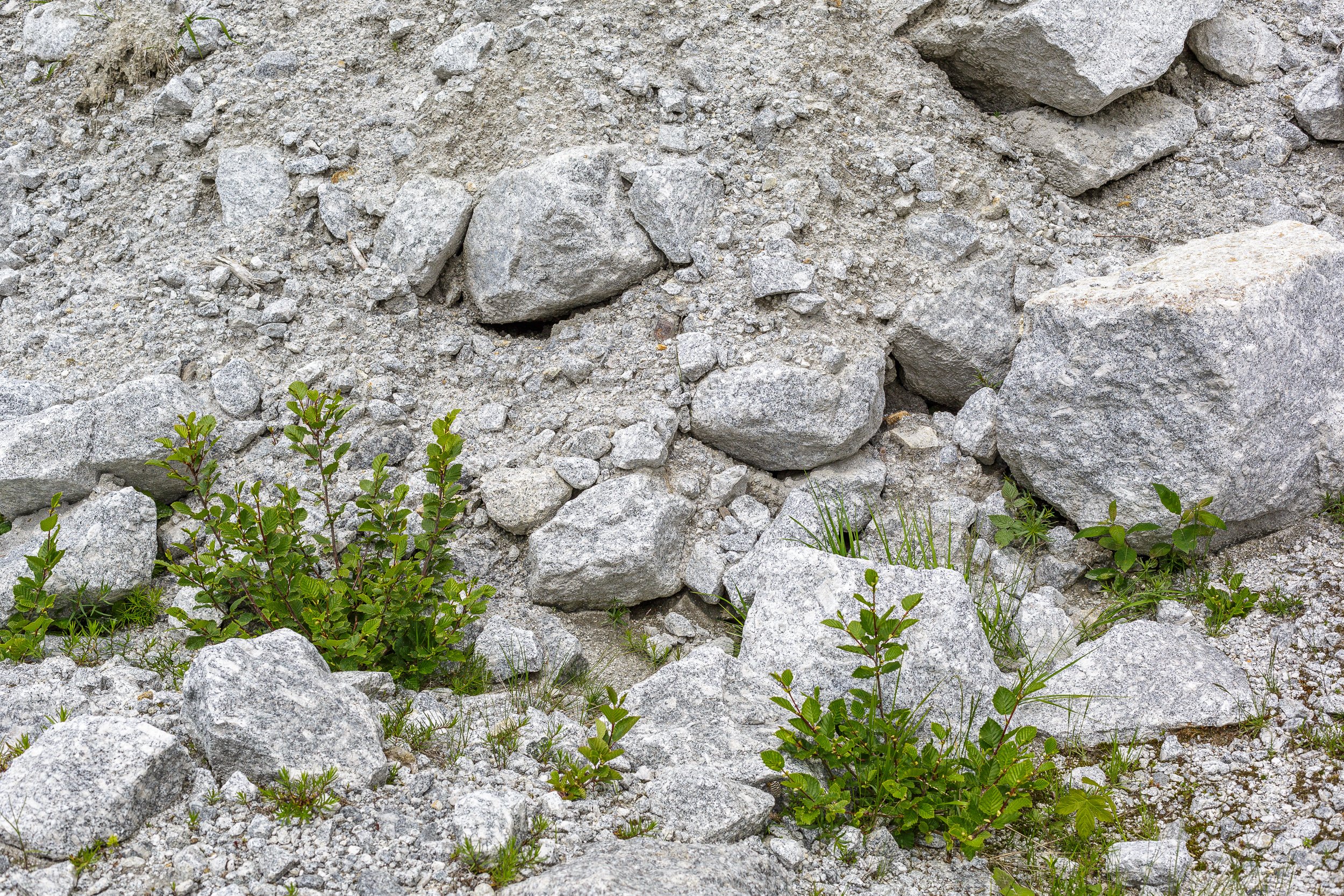
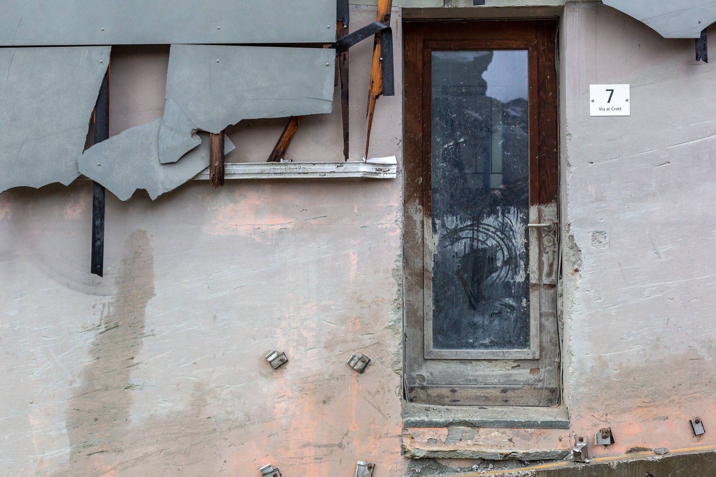
Even six years after the last rockfall, the damage is still visible everywhere. Felled trees remain in awkward positions, living tree trunks have wounds where the rocks hit. Due to the continuing danger of rockfall, the Bondasca has been officially closed since 2017 – hiking trails are barred, a mountain hut popular with climbers has been closed since.
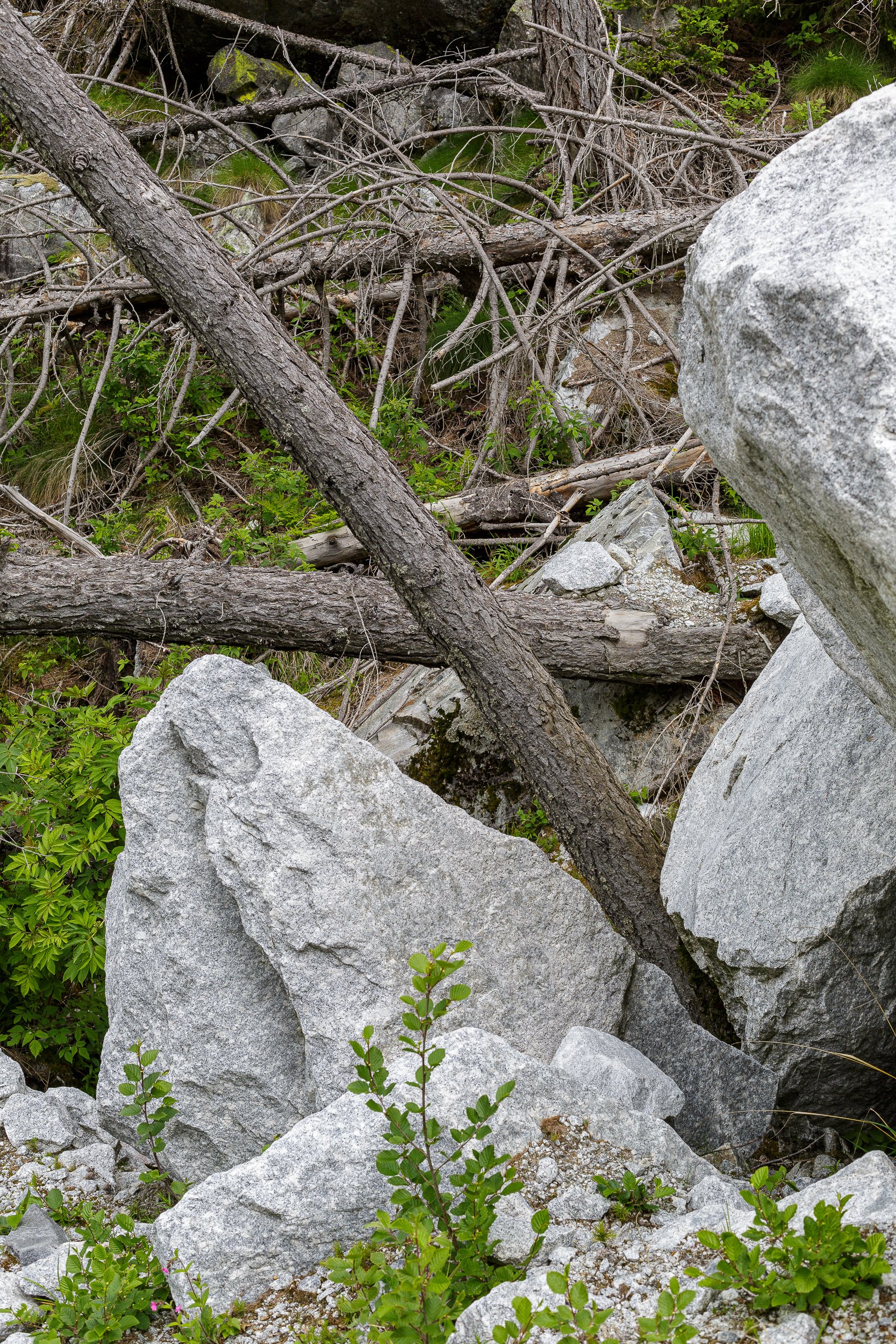
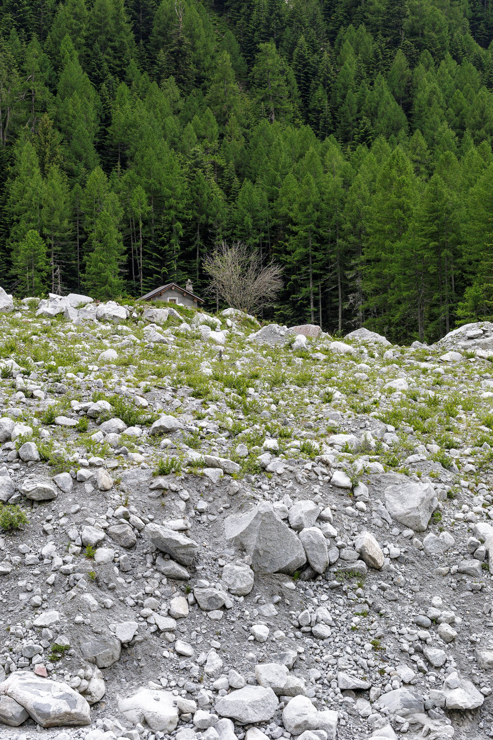
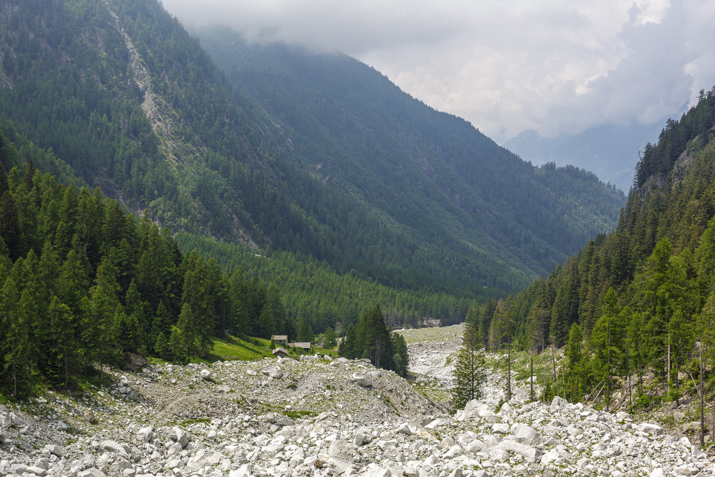
Due to the closure of the valley, it has seen no human intervention for six years. Bushes are growing among the rocks, chamois (mountain goats) are roaming about, birds are chirping.
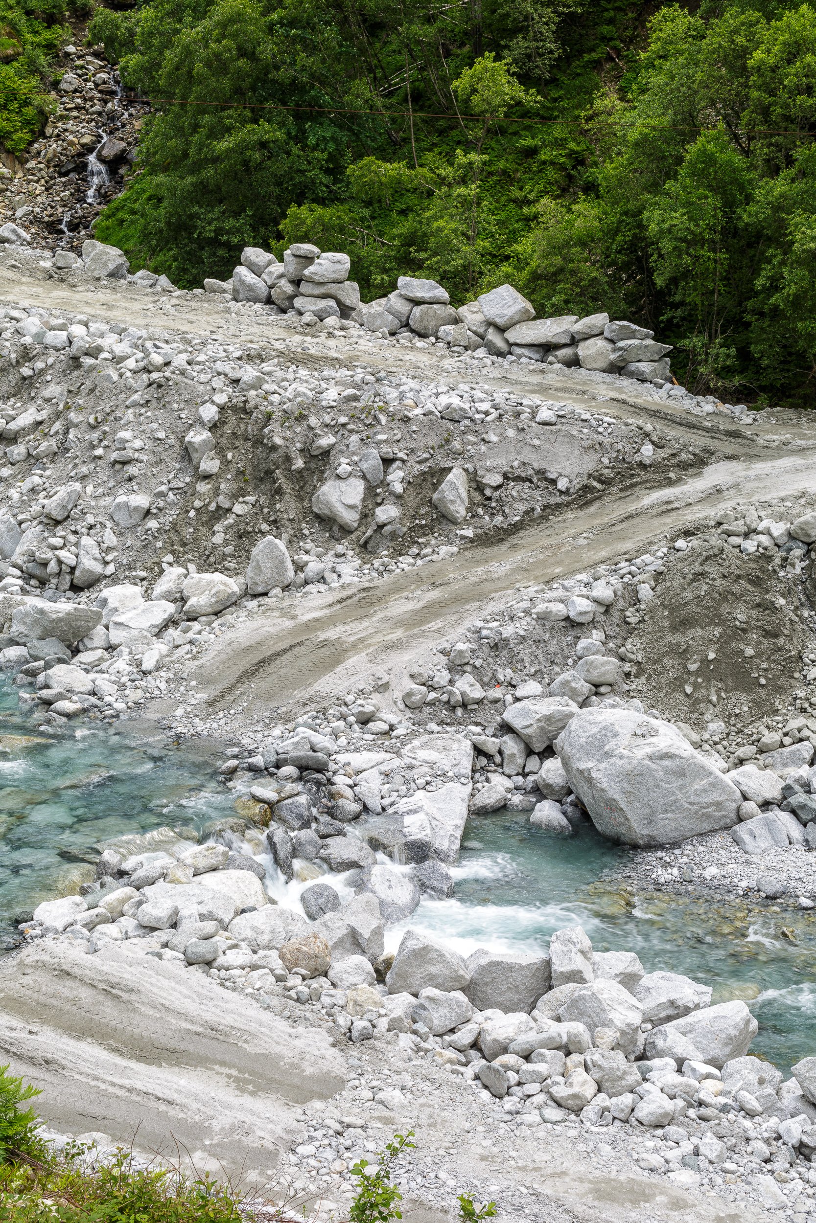
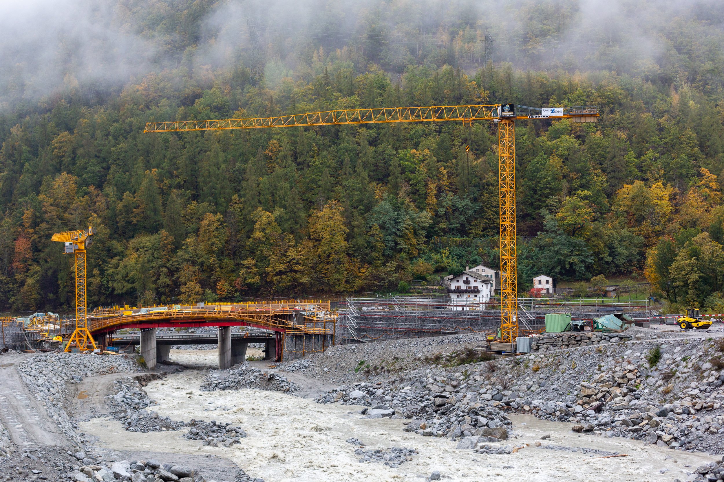
Also humans, however, are reclaiming the valley. A new access trail to the mountain hut is under construction, higher along the valleyside and above the danger zone. An electricity plant that used the water of the Bondasca river is being rebuilt, and therefore the access road and bridge have been replaced.
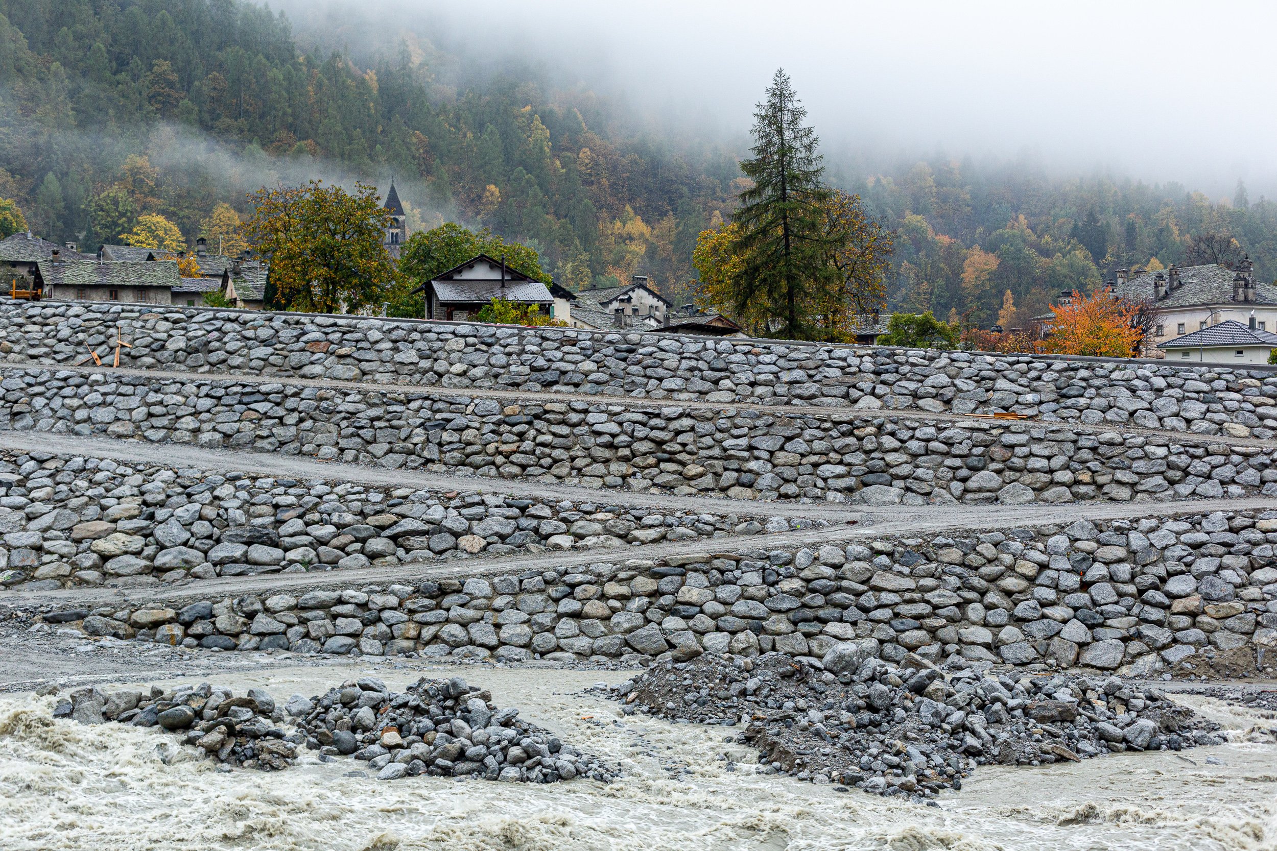
Climate change is affecting nature, our landscapes. In the end, however, we as humans are the most vulnerable – our bodies, our houses, our infrastructure, our agriculture. The village of Bondo lies in the valley where the Bondasca river appears from a gorge. In 2012 and 2017, massive mudflows resulted from the rockfall, burying part of the village. Even after six years, the damage in the village is visible.
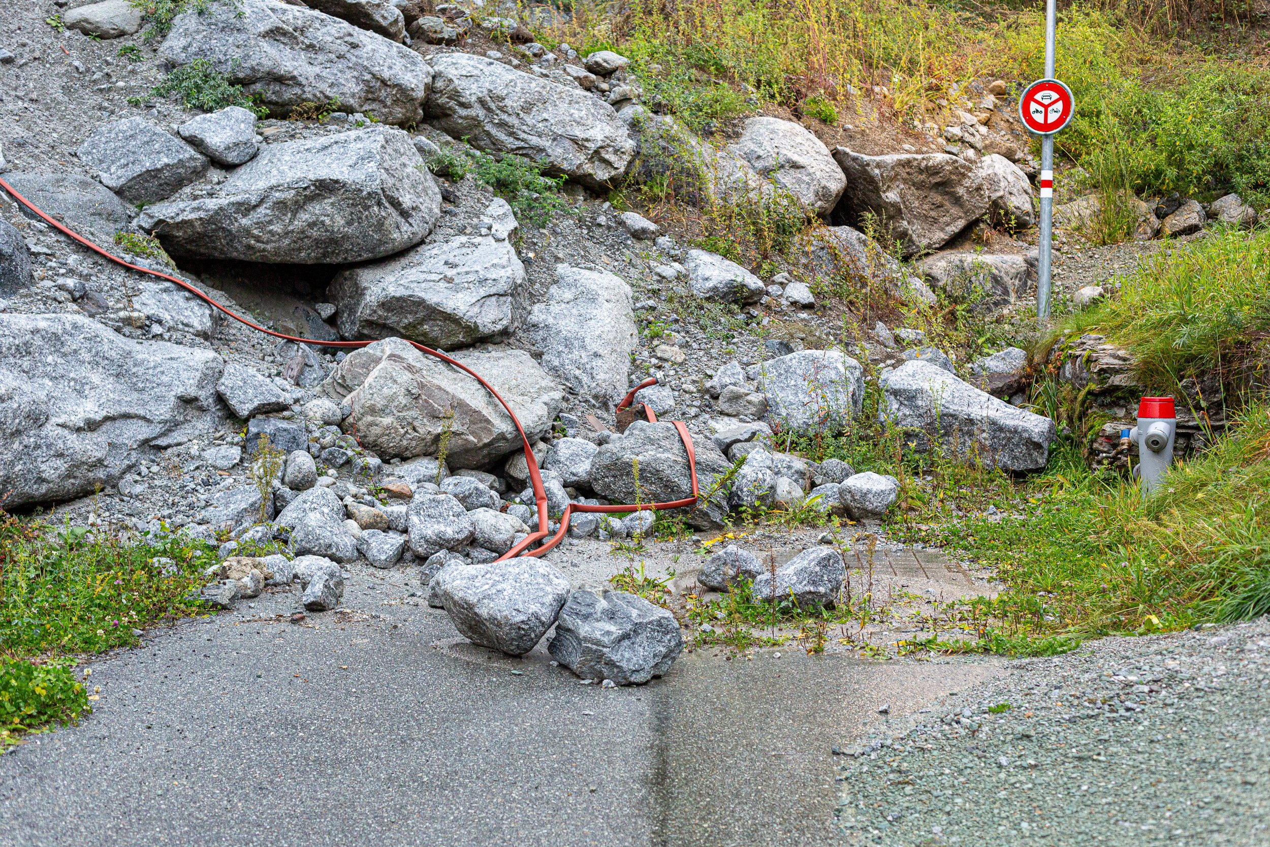
Massive counter measures are taken to redirect future mudflows from the village and new bridges are being built that are higher above the water.
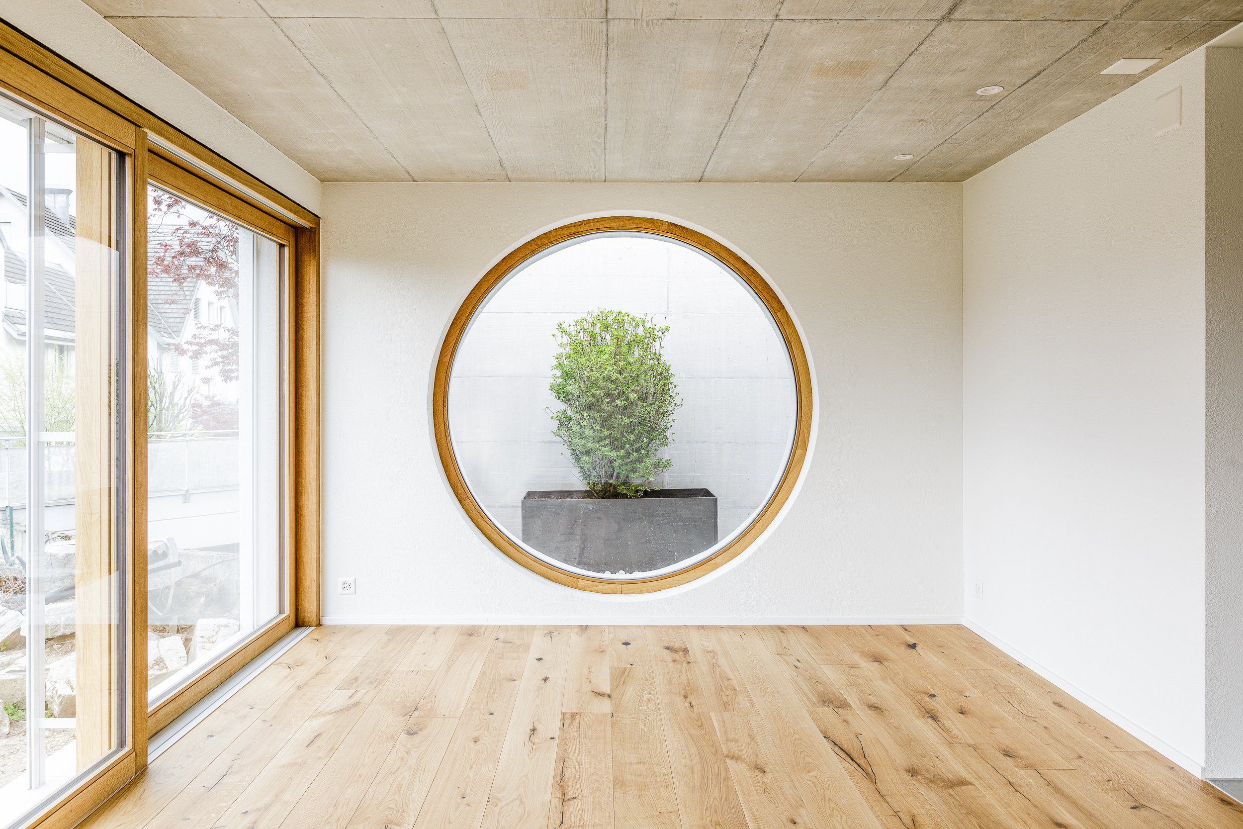
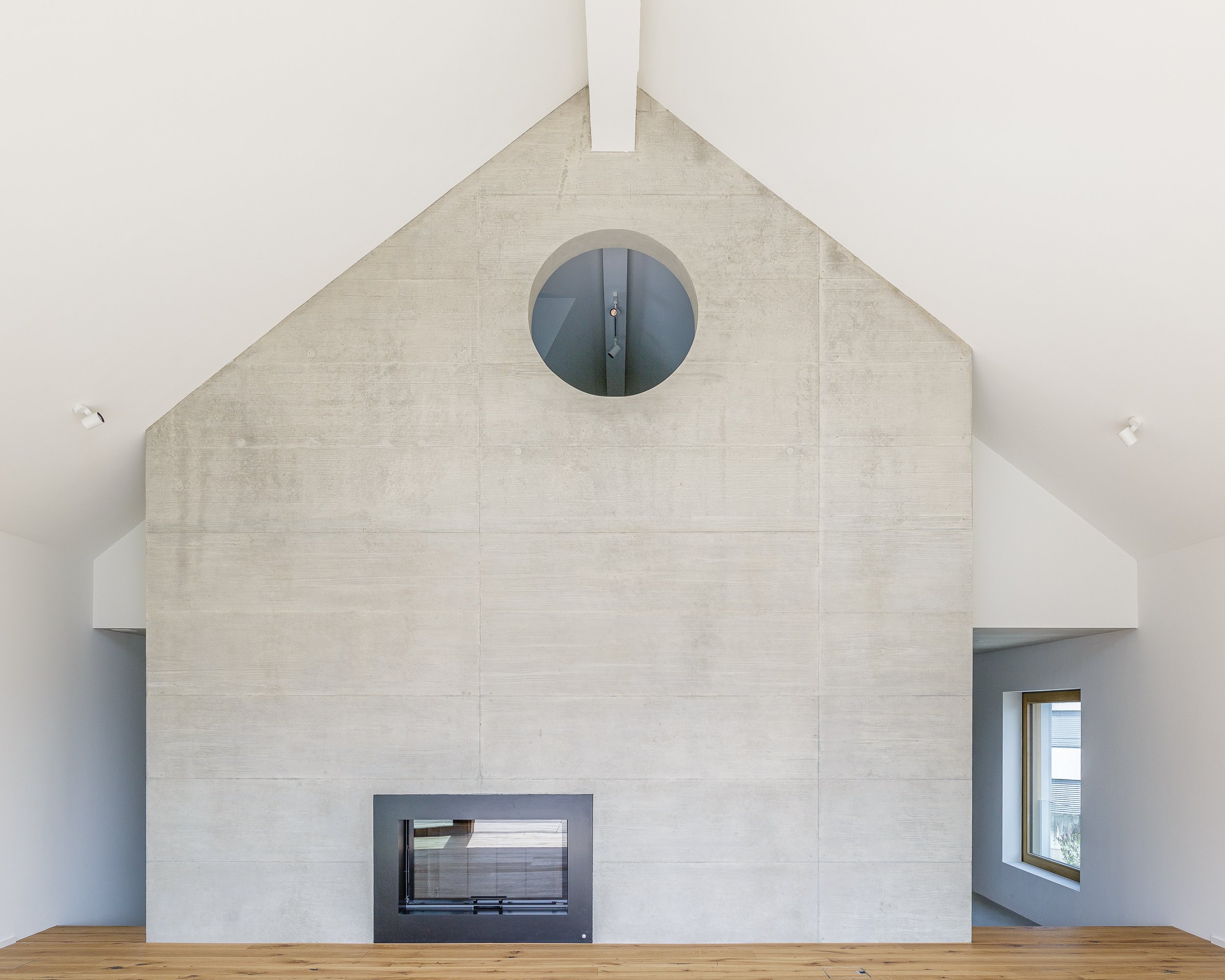
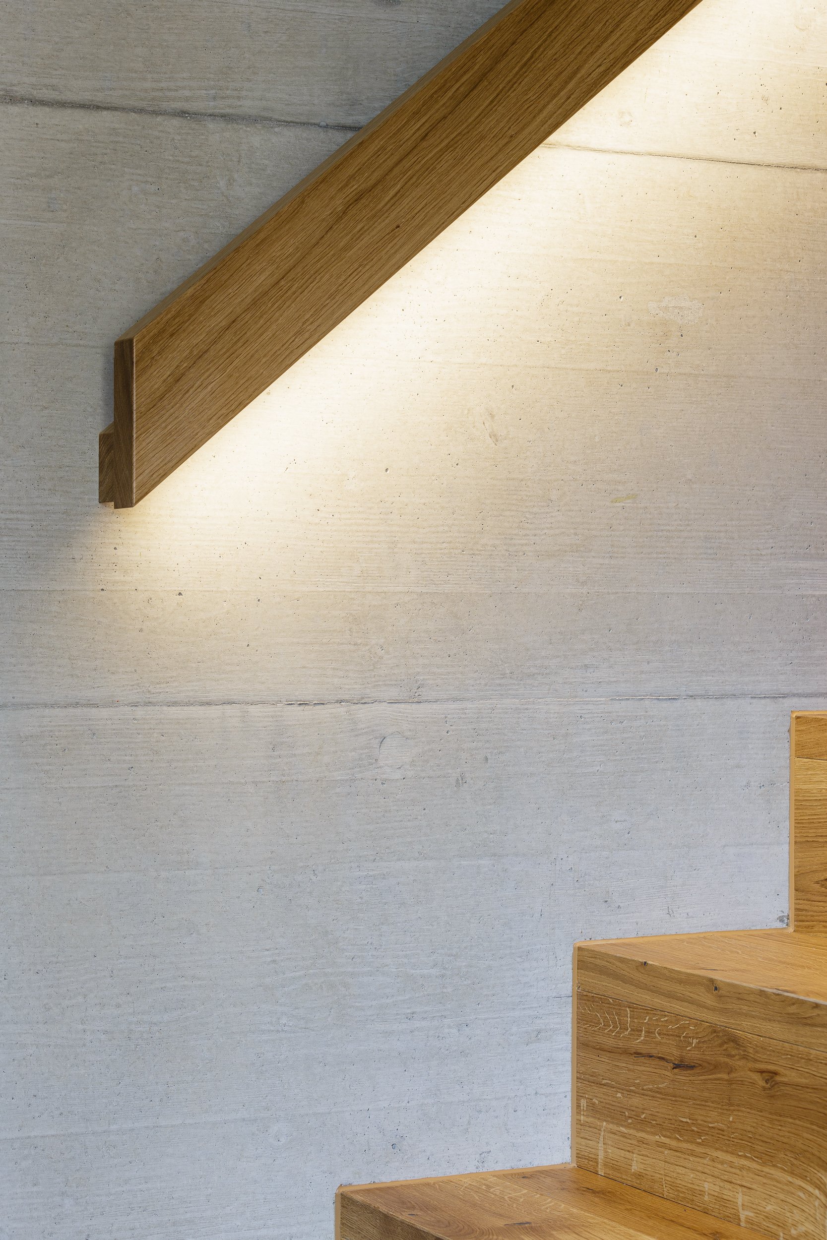
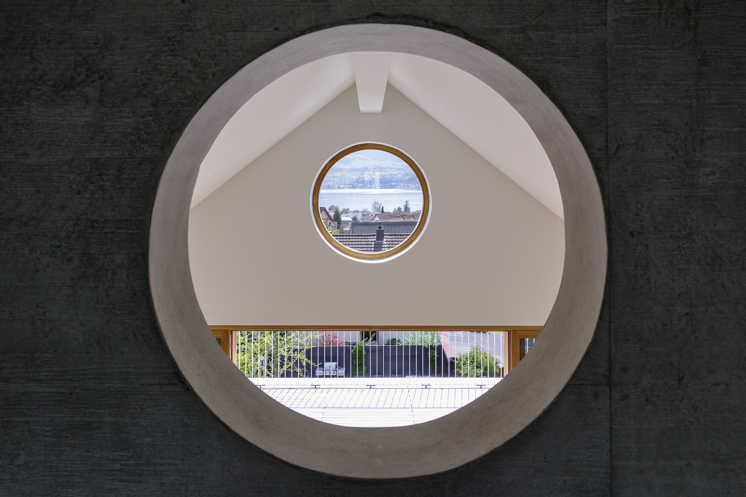
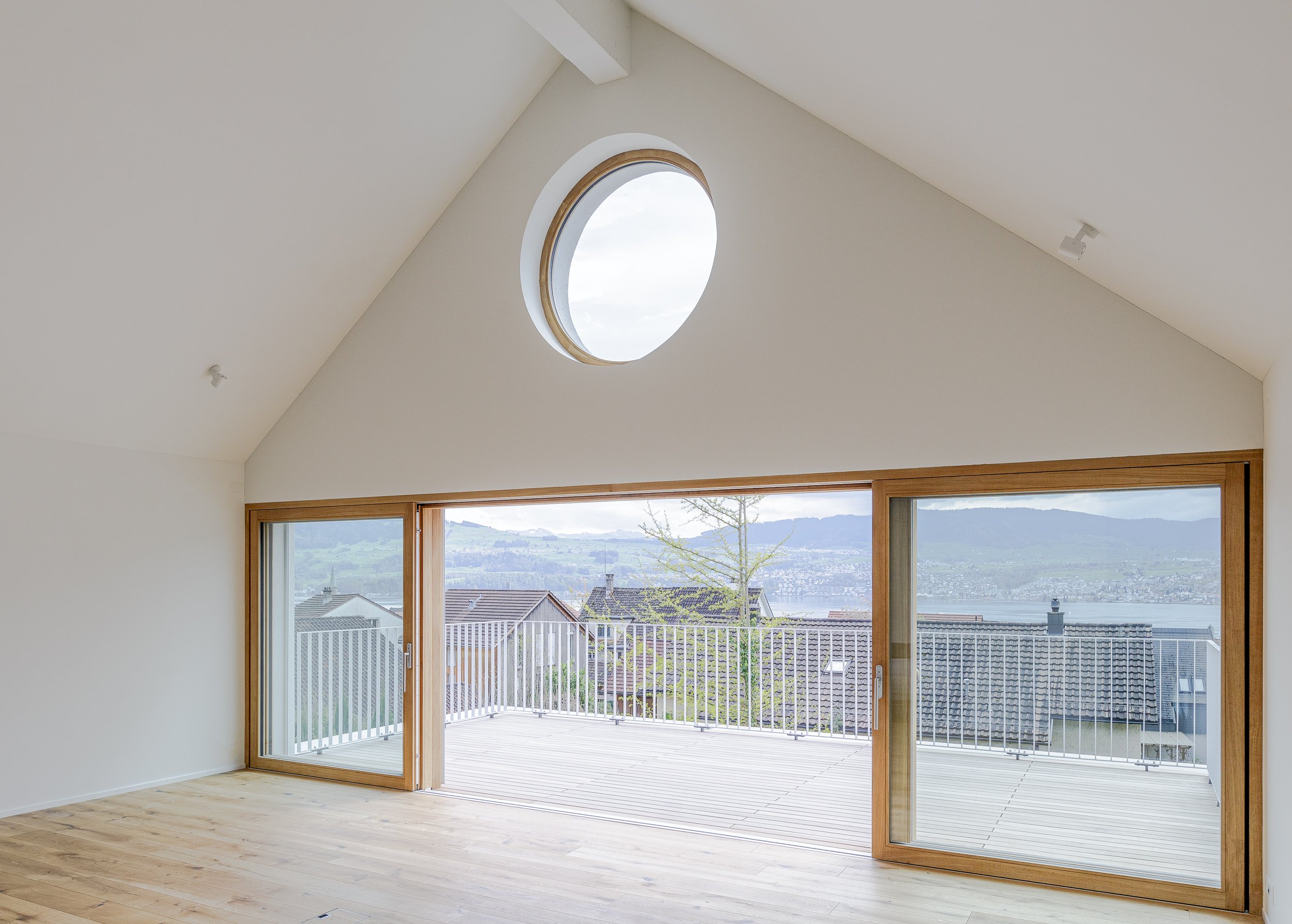
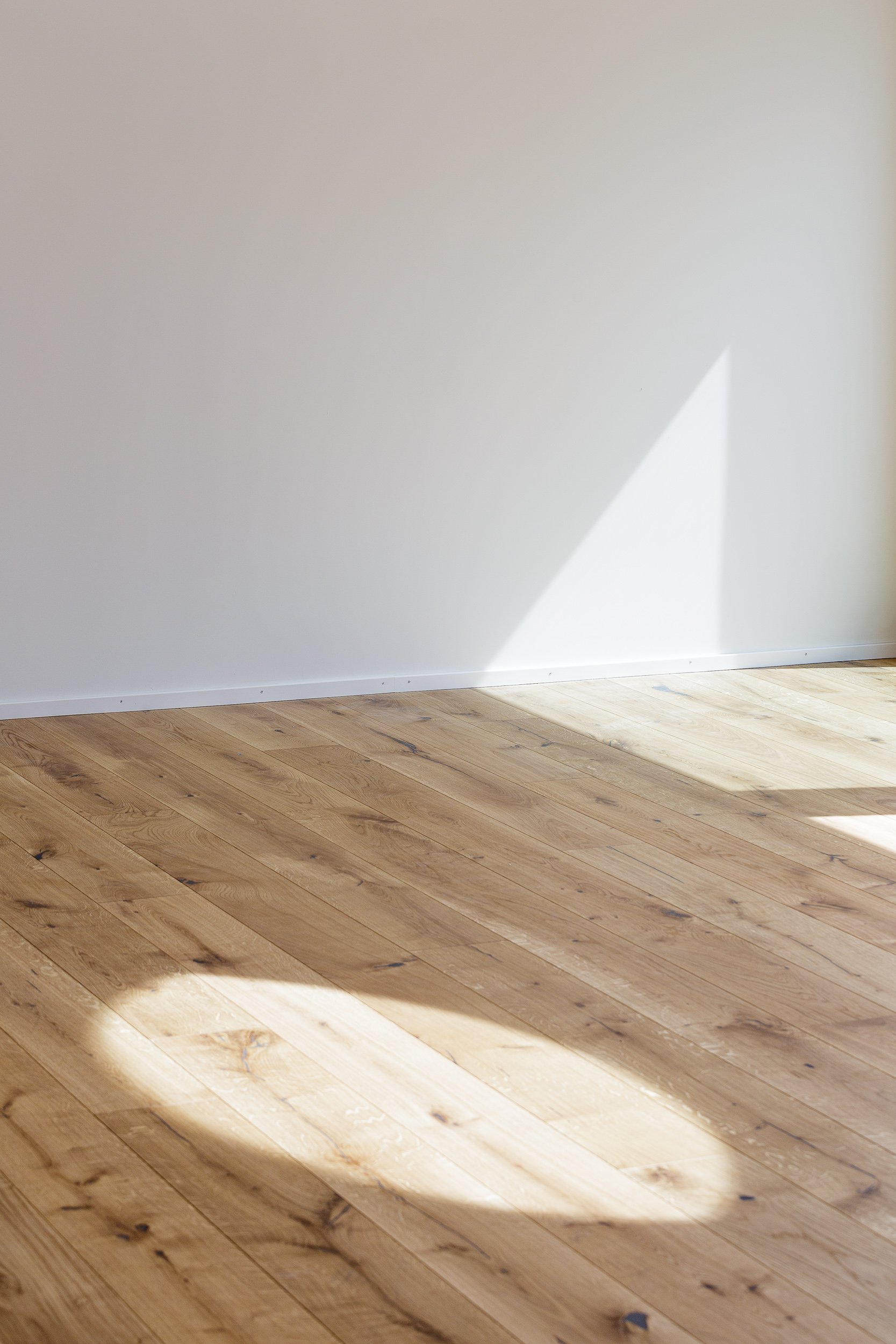
Binzstrasse Stäfa
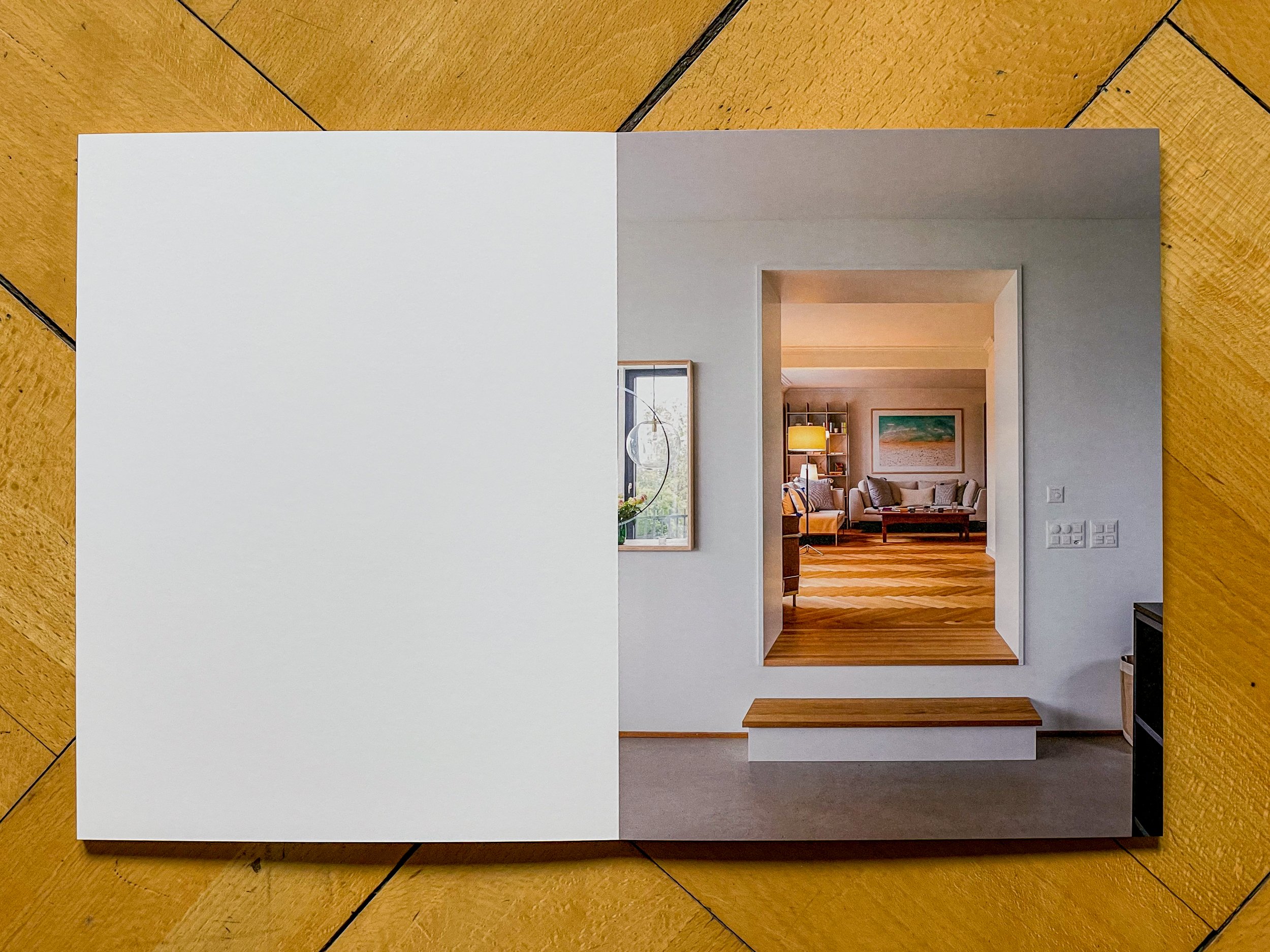
Extension of a single family home by MCA architects.
Extension of a single family home into two apartments by MCA Architekten.
Cultural Landscapes
An ongoing series on urbanised spaces: squares, streets, infrastructure landscapes.
An ongoing series on landscapes shaped by humans: squares, parks, courtyards, infrastructure landscapes, urbanisation.


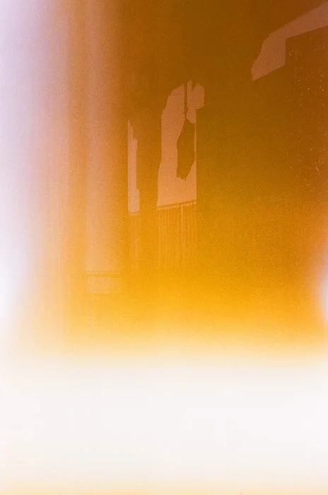
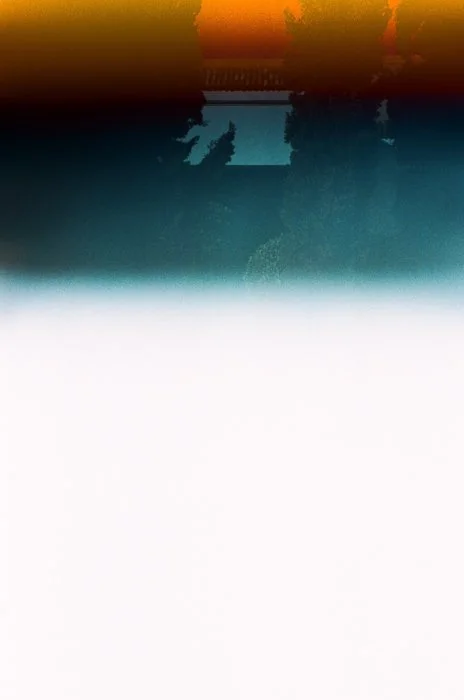
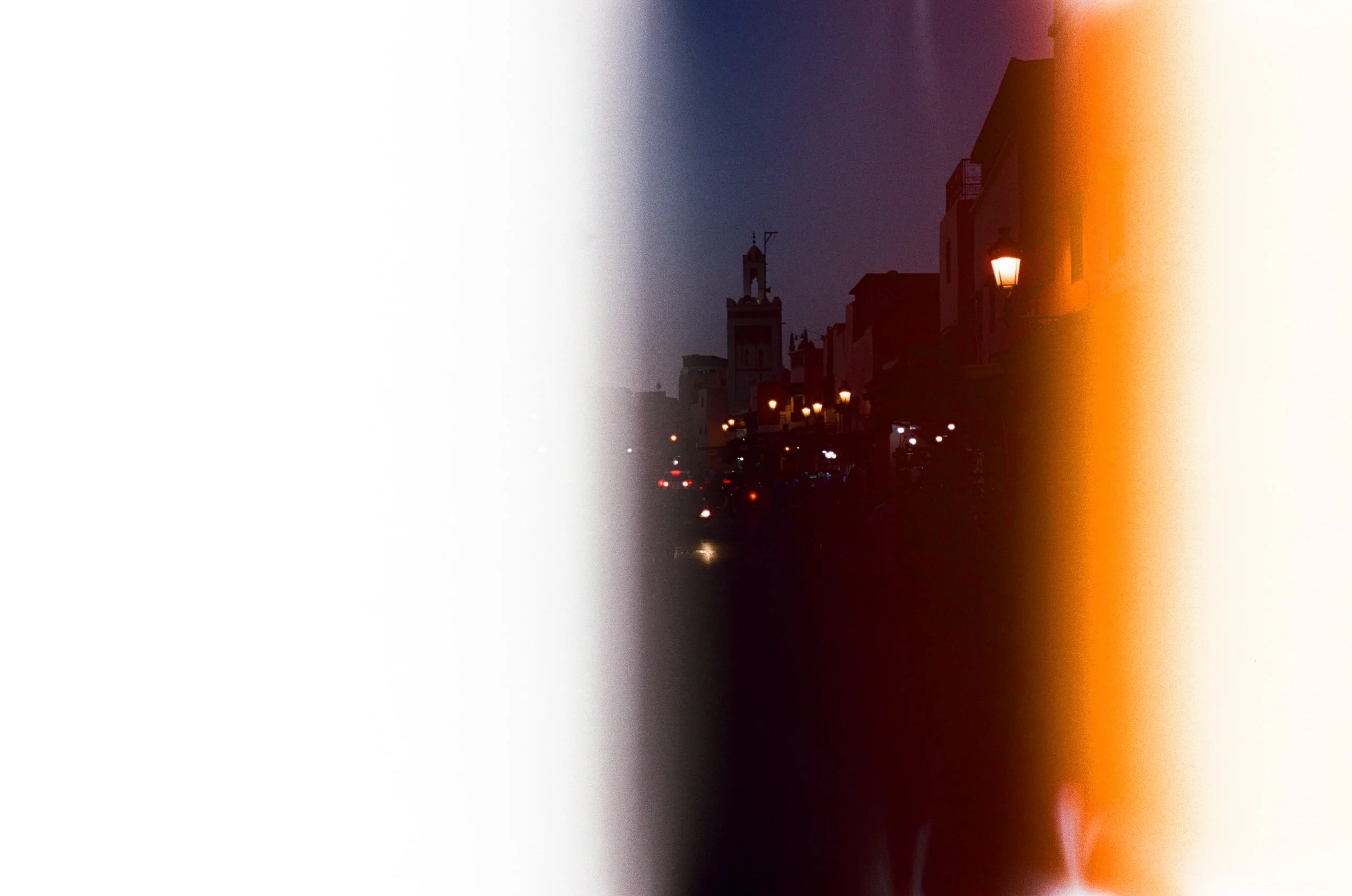
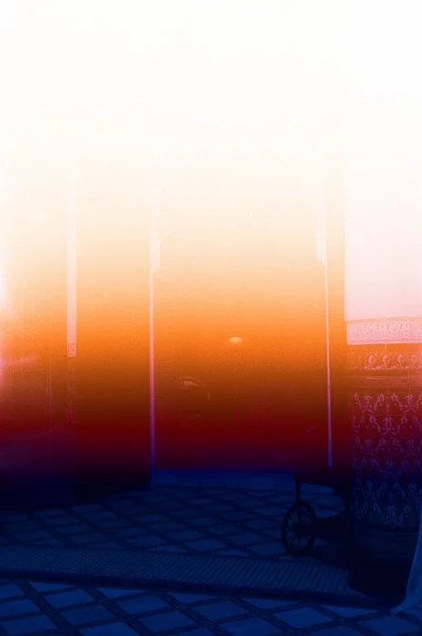
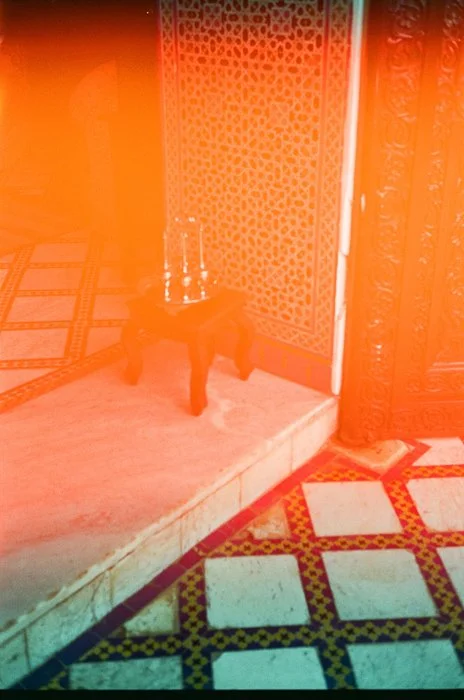
Marrakech
The film turned out to be even blurrier than my memory of a long weekend in Moroccan Marrakech.
Surprise, surprise: the film turned out to be even blurrier than my memory of a long weekend in Moroccan Marrakech. It seems technology really insisted on sticking to Western stereotypes of the “mystical” Middle East. Just add the smell of orange blossom, rose, and gasoline, and there we are. Most images are from Palais Layadi.


zweizimmer
Exhibition photography.
Exhibition documentation in collaboration with Aaron Amar for zweizimmer, curated by @evelynvonesch, @paulaknill, @mmmarameier.
Works by @nasrin.amiri.ram, @anabalanaa, @_aaron_amar, @hahahafner, @szka.11, @inesmaestre, @peanut_colada_, and #MoritzSchönbrodt.


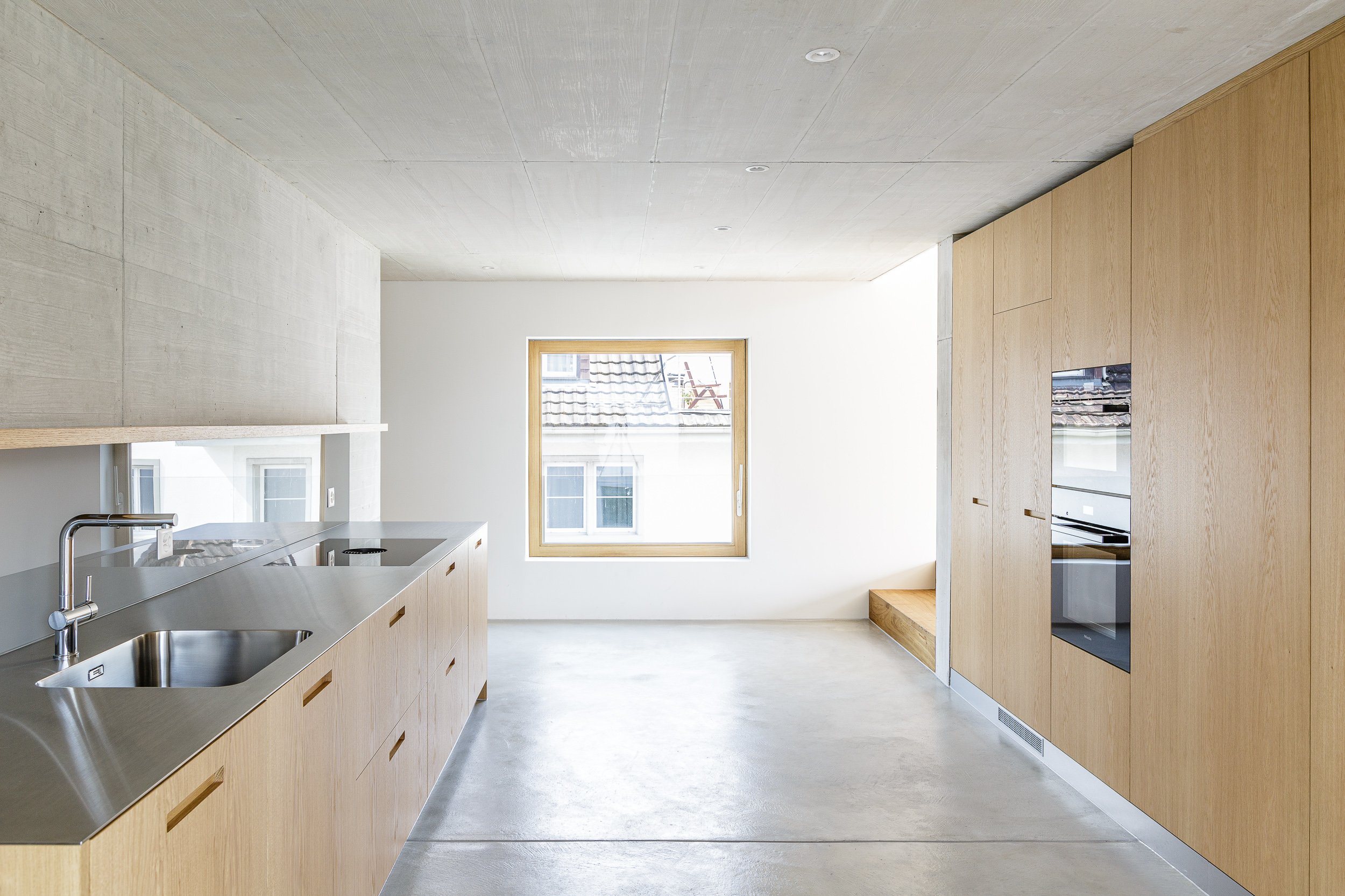
Extension Forch House
Extension of a single family home.
Extension of a single family home near Zurich by Salewski Nater Kretz Architekten.
Book self-published, printed and bound by Bubu.


Verzasca
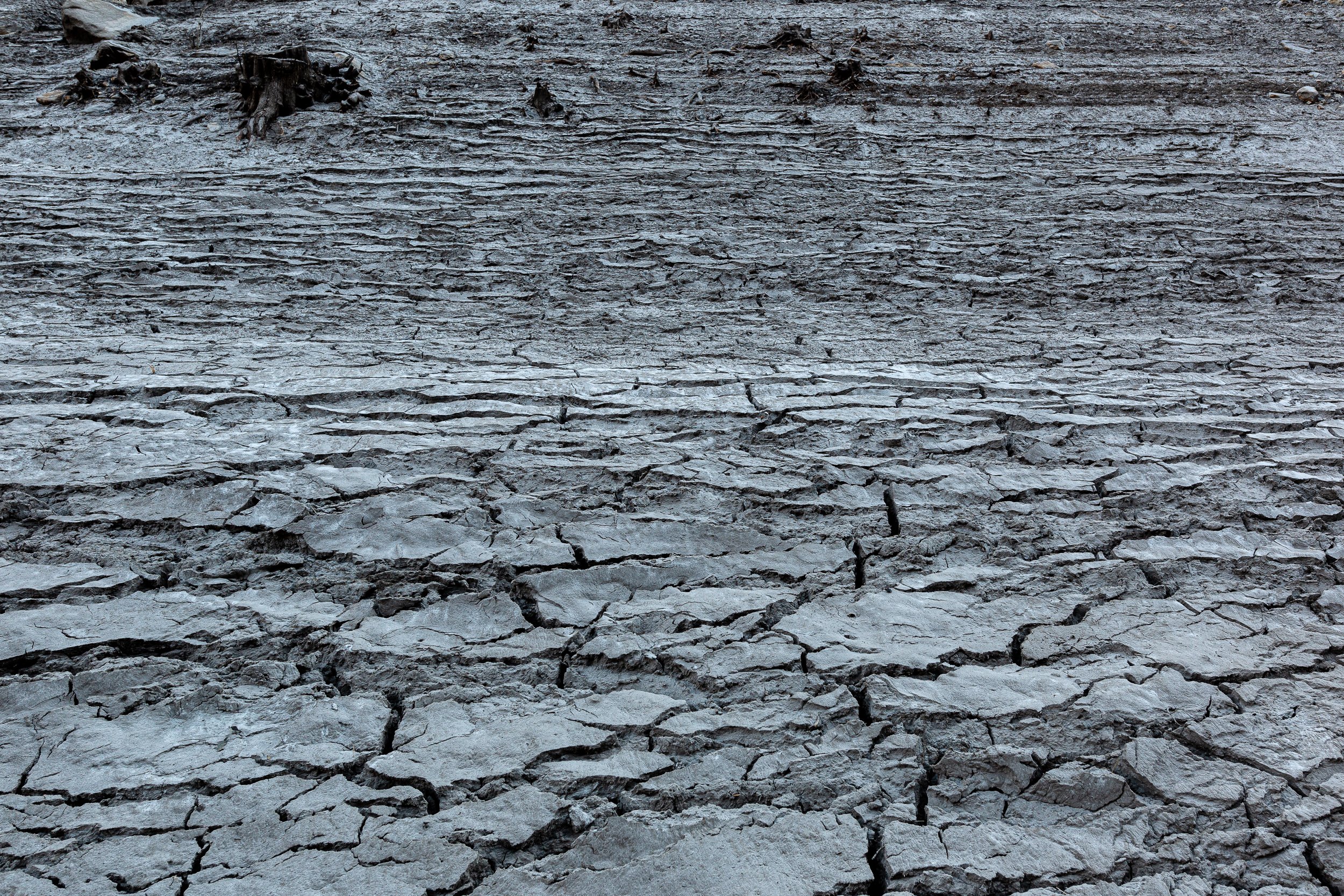
Trees, foundations of houses, terraced vineyards, and a road with several bridges covered in sand, rocks, and mud that takes weeks to dry out.
In late 2021, the reservoir lake in Val Verzasca (Switzerland) was emptied for repairs. A landscape resurfaced that had been submerged since the dam’s construction in 1965: trees, foundations of houses, terraced vineyards, and a road with several bridges covered in sand, rocks, and mud that takes weeks to dry out.


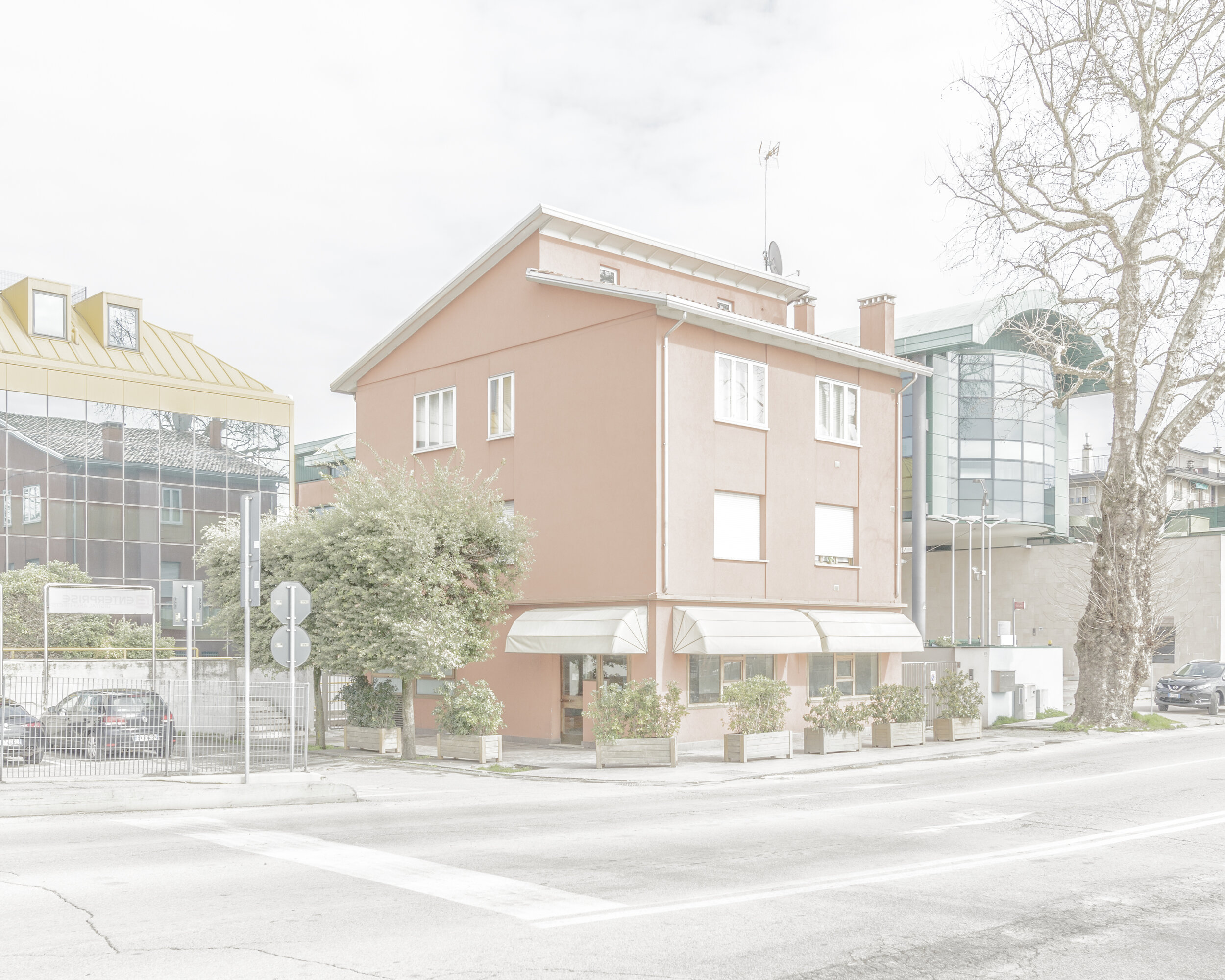
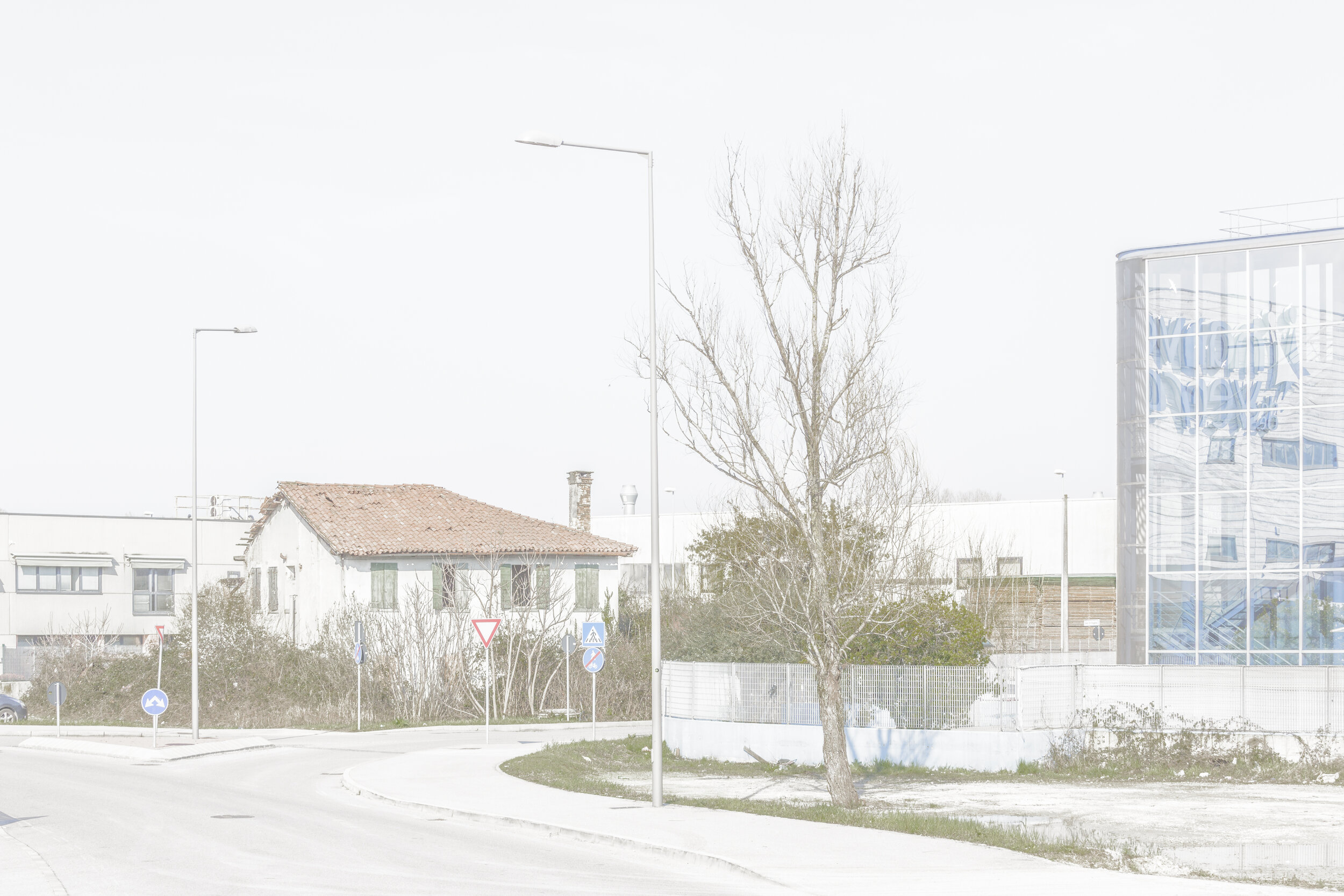
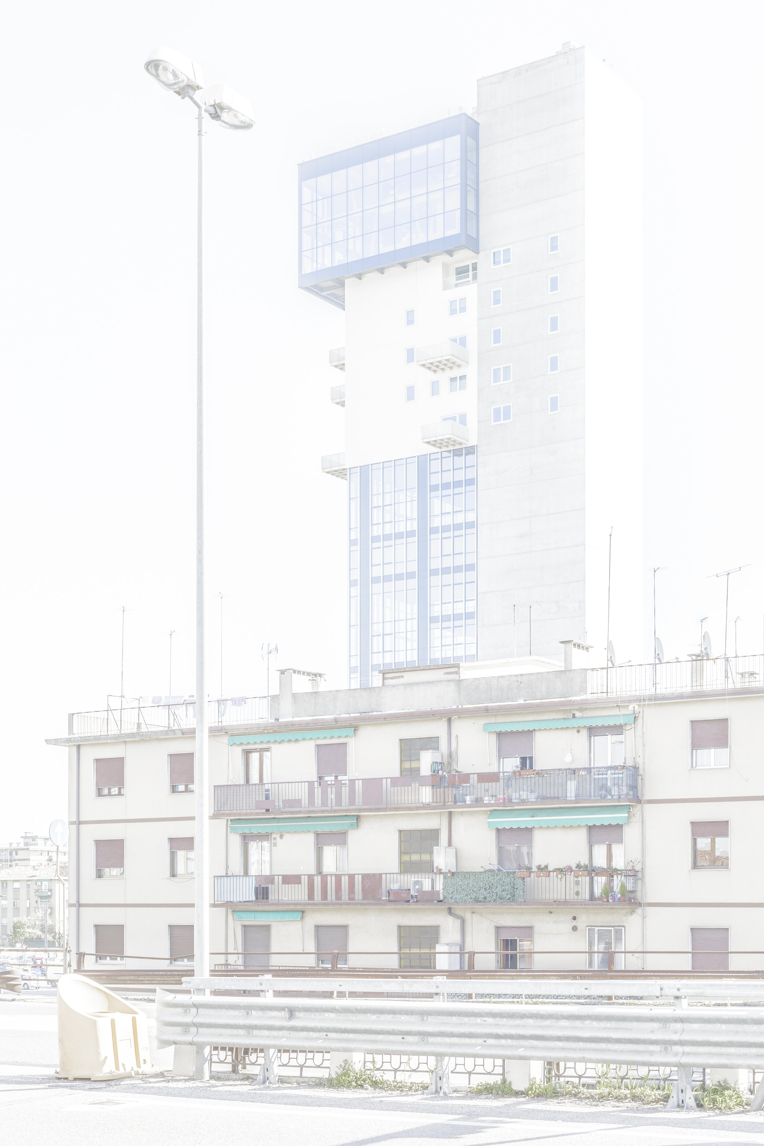
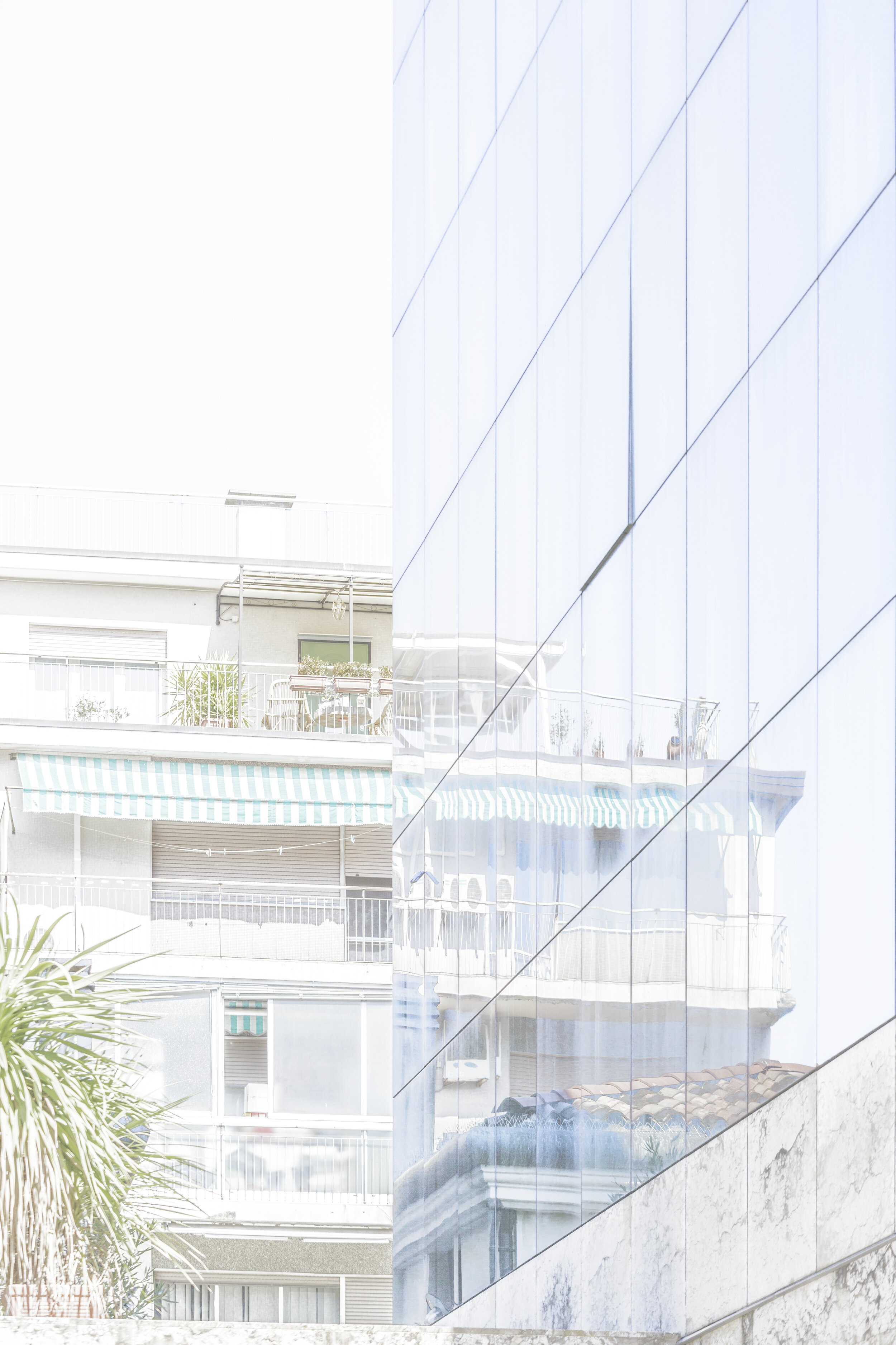
Sogni italiani
Italy. Ancient ruins, baroque palaces, and turbulent politics. Memories, dreams, projections, platitudes. An ongoing series somewhere between allure and kitsch.
Italy. Ancient ruins, baroque palaces, and turbulent politics. Memories, dreams, projections, platitudes. An ongoing series somewhere between allure and kitsch.


Trinacria
The Greek word Trinacria means ‘three-pointed’ and is the earliest known name of the island of Sicily, derived from its triangular shape. The symbol of the head of Medusa, surrounded by three legs and three stems of wheat, adorns the flag of this Italian province.
The Greek word Trinacria means ‘three-pointed’ and is the earliest known name of the island of Sicily, derived from its triangular shape. The symbol of the head of Medusa, surrounded by three legs and three stems of wheat, adorns the flag of this Italian province.
The photographic series investigates the history of buildings and materials by highlighting the wear and tear of centuries of usage, additions to and reconstructions of buildings, spontaneous vegetation or informal improvsations.


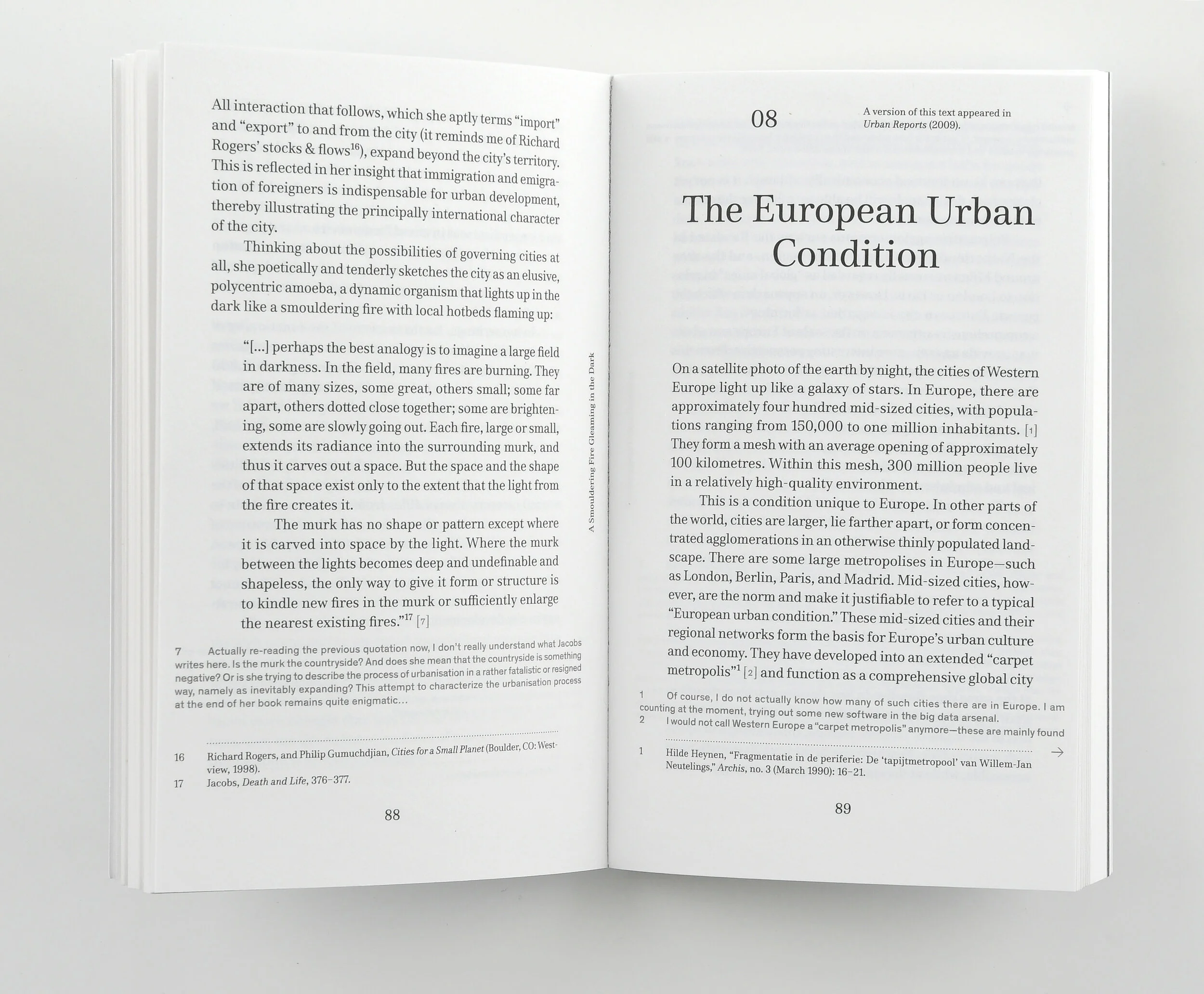
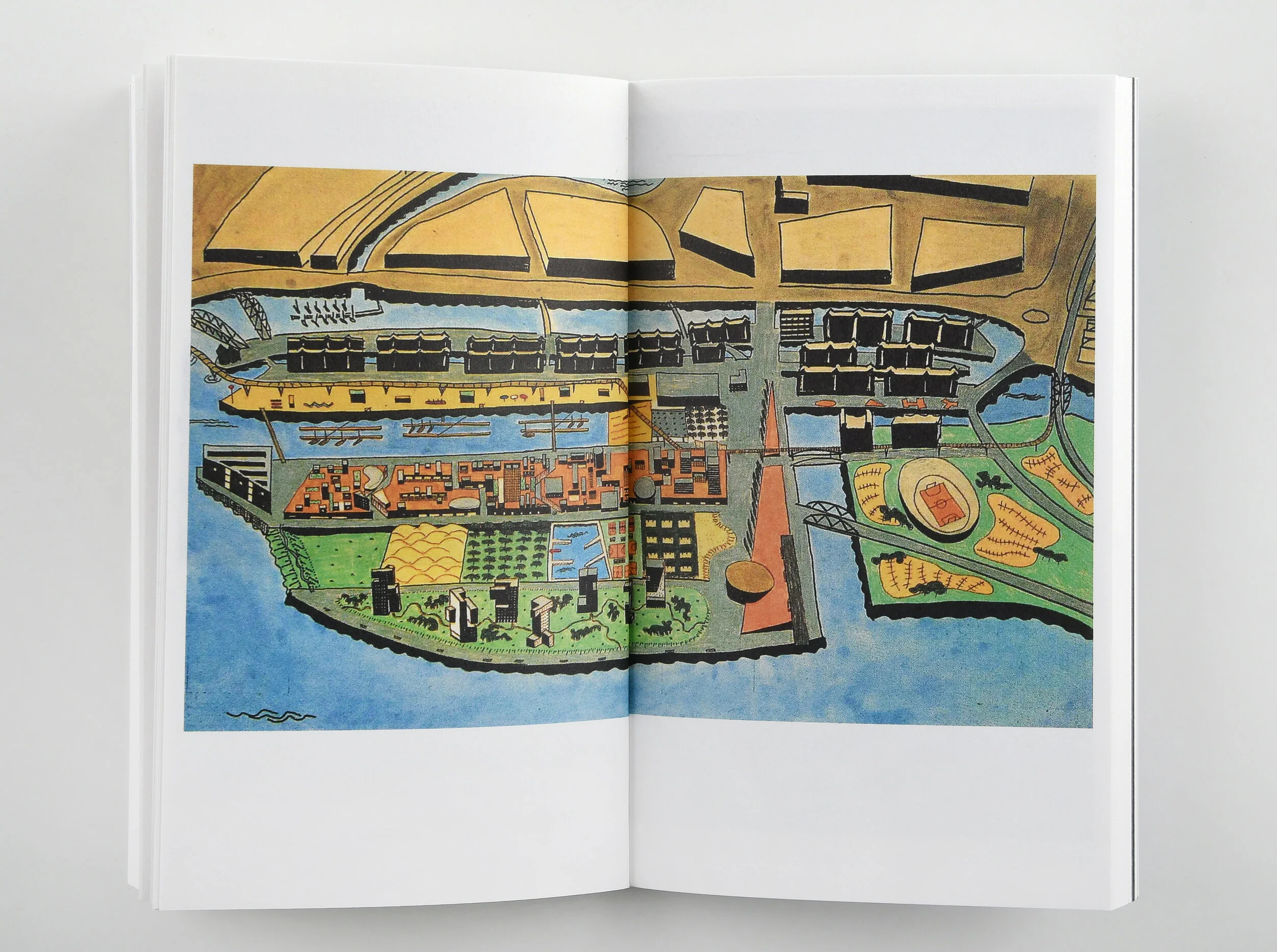
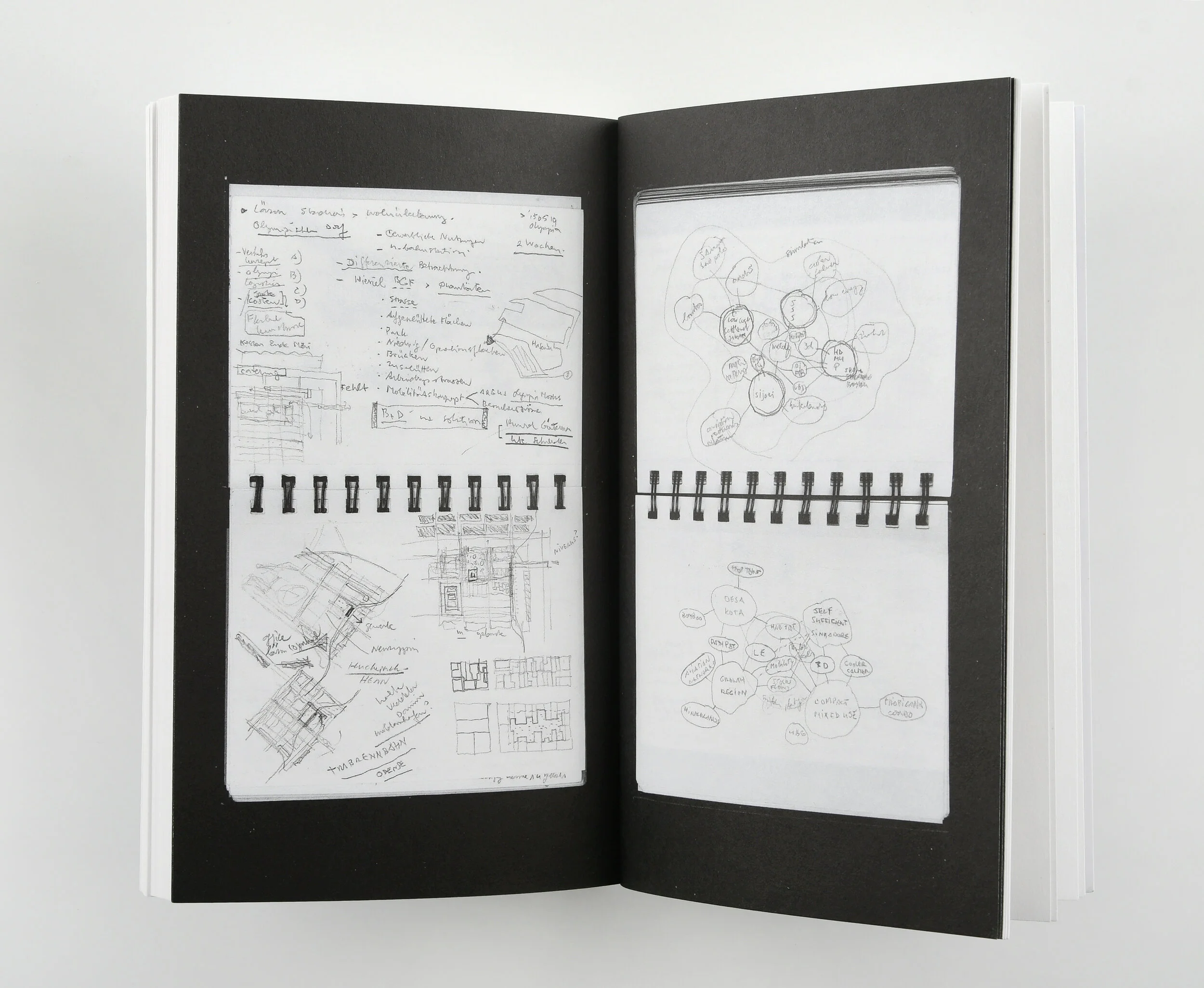
Kees Christiaanse Textbook
Textbook spans 30 years of the well-known urban designer and architect Kees Christiaanse’s thinking about cities.
Textbook: Collected Texts on the Built Environment 1990–2018.
Kees Christiaanse (author), Jessica Bridger (editor), Joris Jehle (assistant editor), Studio Joost Grootens (graphic design).
Kees Christiaanse is one of the field’s most influential forces in urban design over the last half-century. Textbook spans 30 years of the well-known urban designer and architect Kees Christiaanse’s thinking about cities. He is responsible for large urban projects, including Hamburg HafenCity, Rotterdam’s waterfront revitalization and London’s Olympic Legacy Plan.
As assistant editor, it was my responsibility to coordinate the collaboration between author, editor, publisher, and graphic designer. Furthermore, I translated many of Kees’ articles and essays from either German or Dutch to English, assisted in the editing of the texts, and in the selection of texts to be included in the book.
Venezia Mestre
A residential town, a suburb, a logistics centre, quasi backstage of the «Disneyland Venice,» its hinterland.
Studienreise: ETH Zürich, Seminarwoche FS18, Professur Kees Christiaanse: Veduten der Vor-Stadt. Fotografische Untersuchung in Mestre, Venedig.
Konzept, Vorbereitung und Durchführung: Joris Jehle.
Mestre.
Eine Schlafstadt, ein Vorort, ein Logistikzentrum, quasi Backstage des «Disneylands Venedig», sein Hinterland.
Ohne Mestre kein Venedig
Hier befinden sich der grosse Güterhafen und günstige Unterkünfte für Arbeitspendler_innen. Der Tourismusmoloch Venedig giert nach Dienstleistung, nach Arbeitskräften. Zunehmend aber wohnen in Mestre auch Venedigs ehemalige Bewohner_innen, die sich die Lagunenstadt der hohen Preise wegen nicht mehr leisten können: während die Bevölkerung der Altstadt ständig schrumpft, nämlich von 200’000 um das Jahr 1600 auf 120’000 in 1980 und magere 55’000 in 2016, wuchs die Bevölkerung auf dem nahen Festaland im selben Zeitraum von knapp 10’000 auf aktuell über 180’000. Die Agglomeration von Mestre übernimmt viele – auch ungeliebte – Funktionen der Stadt, die im Touristenzentrum keinen Platz mehr finden.
Mestre!
Im 20. Jahrhundert folgte die Urbanisierung des Festlandes in und um Mestre ähnlichen Mustern wie überall in Italien und wie vielerorts in Europa: Um das kleine historische Stadtzentrum entstanden in den 1950er Jahren gesichtslose Randzonen. Ein weiterer Ring der Zersiedlung in Form von Businessparks, Logistik- und Industriegebieten – in Gebrauch oder brachliegend – drückt von aussen auf den Kern. Ein breites Band von Autobahnen, Zubringern und Gleisen zerschneidet die Ortschaft und ab den 1970er Jahren schossen an ihrem Rand die üblichen Einkaufszentren und Multiplexkinos aus dem Boden.
Eine fotografische Untersuchung
Die Idee der fotografischen Untersuchung ist so alt wie die Fotografie, wurde aber erst in den 1980er Jahren stark gefördert. In Frankreich lancierte der Staat selber die Idee und beauftragte namhafte Fotografen wie Raymond Depardon, Josef Koudelka, Lewis Baltz oder Gabriele Basilico, die Veränderungen unserer Umwelt auf ihre eigene Art und in ihrer eigenen Bildsprache festzuhalten.
Wir untersuchten und erkundeten Mestre zu Fuss und mit der Kamera. Wir wollten herausfinden, wie sich Urbanisierungstendenzen in Italien manifestieren und sichtbar werden und wie die Entwicklung Mestres mit der Destination Venedig zusammenhängt.
In den vier Tagen in Mestre lag der Schwerpunkt auf dokumentar-fotografischen Herangehensweisen und auf Strategien der Bild- und Themenfindung. Es sollte aber auch auf allgemeine Fragen der fotografischen Praxis und Technik eingegangen werden. Wir wurden dabei vom Fotografen Marc Latzel begleitet und betreut.
In der Galerie finden sich meine eigenen Bilder, die während der Seminarwoche entstanden sind.

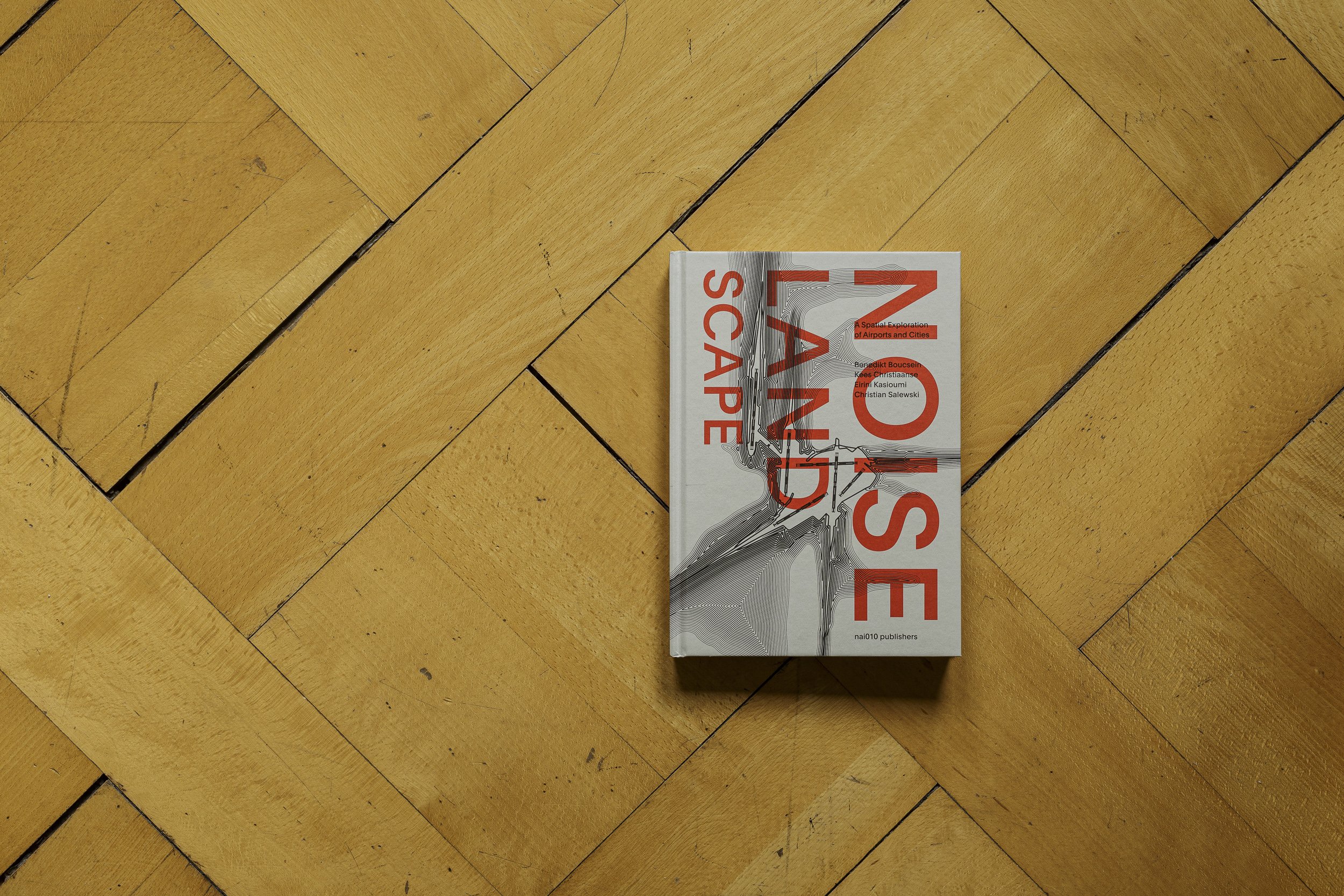
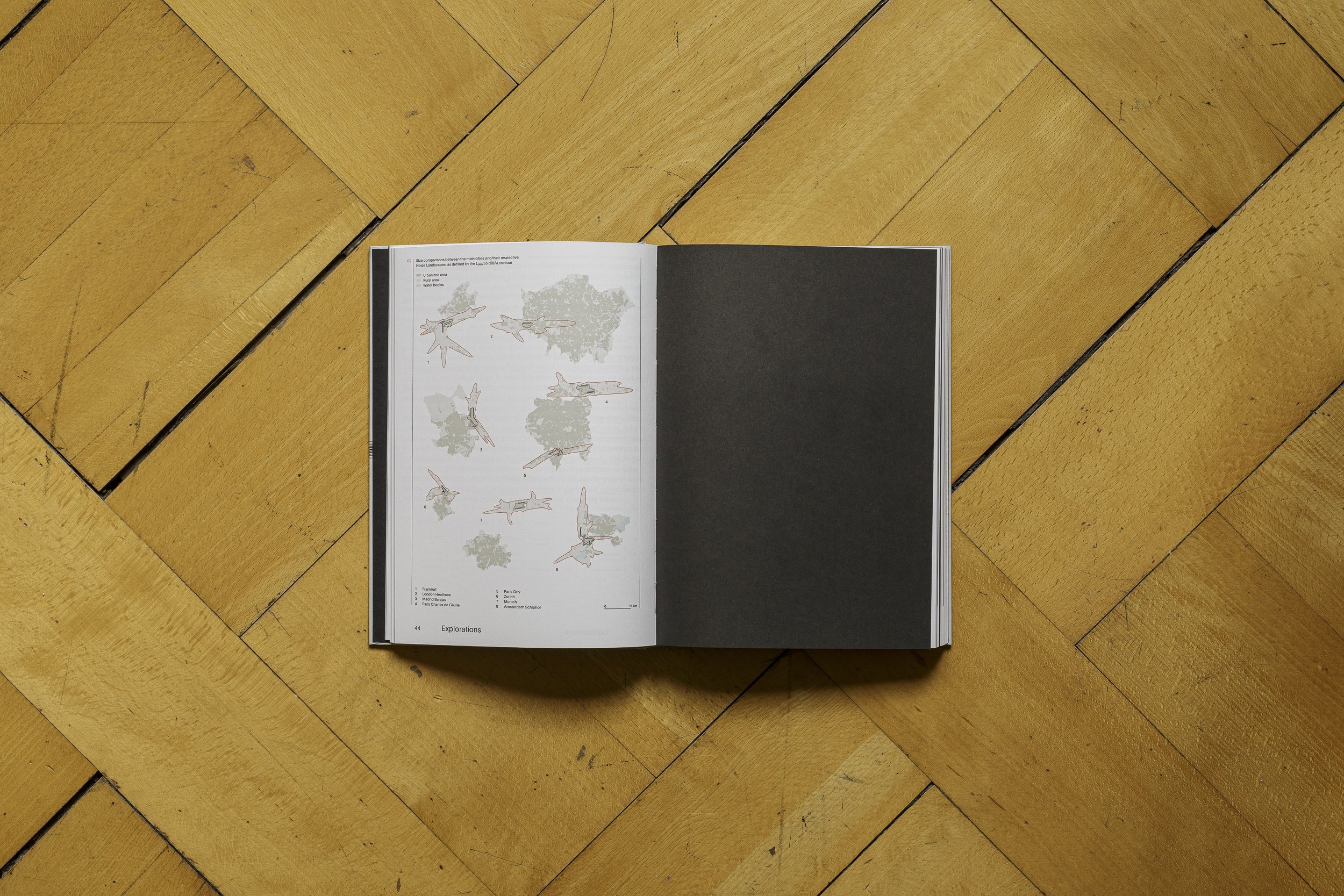
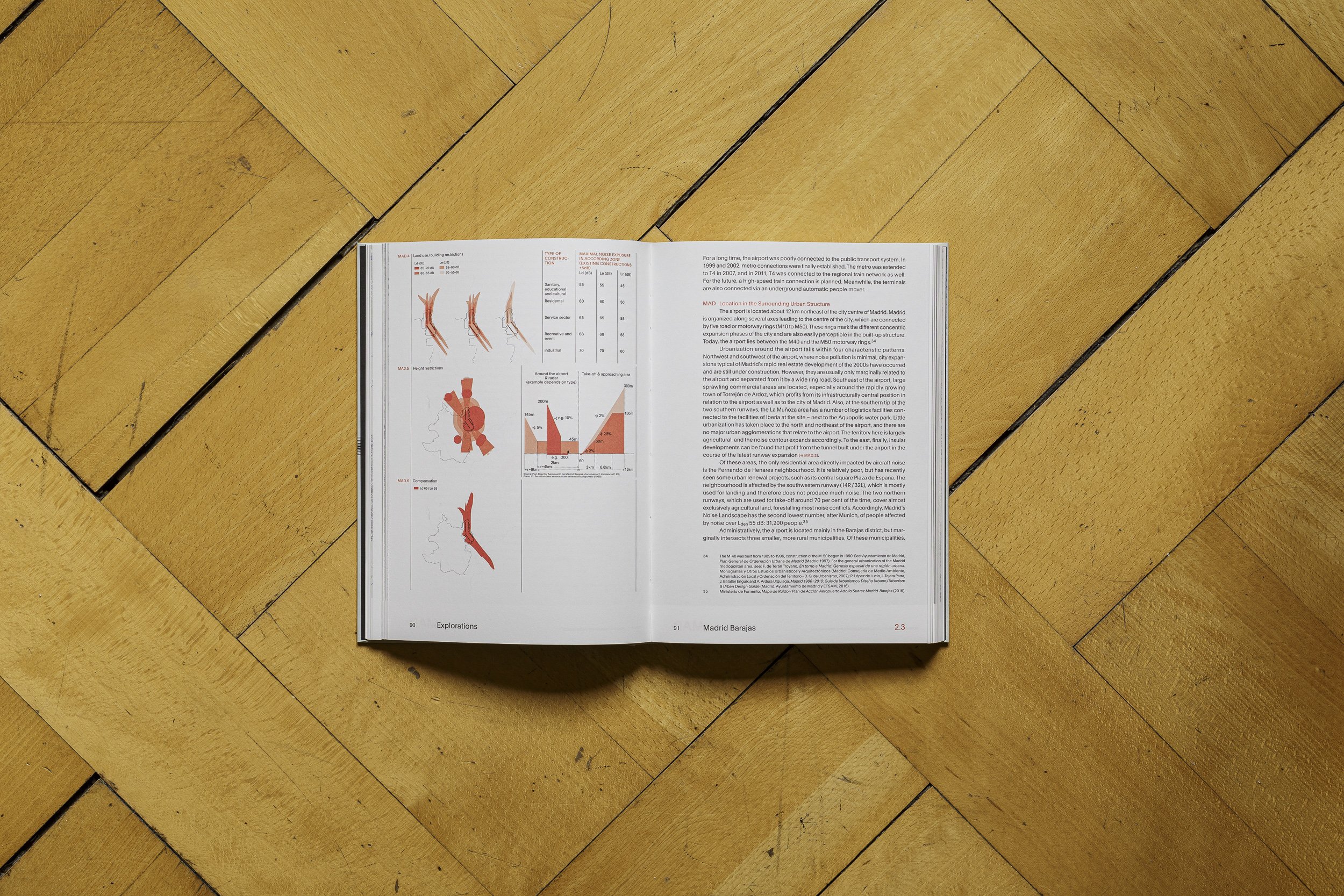
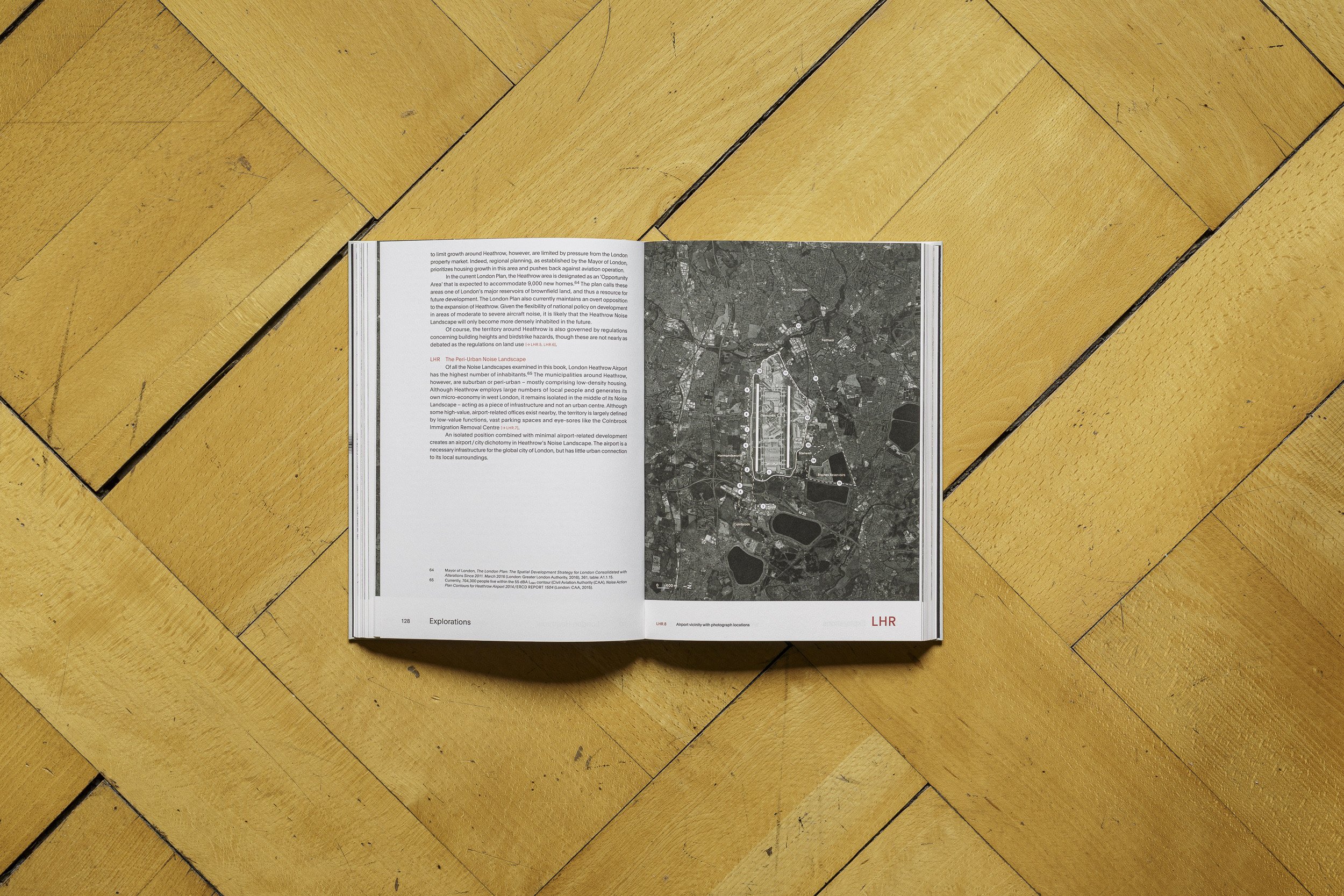
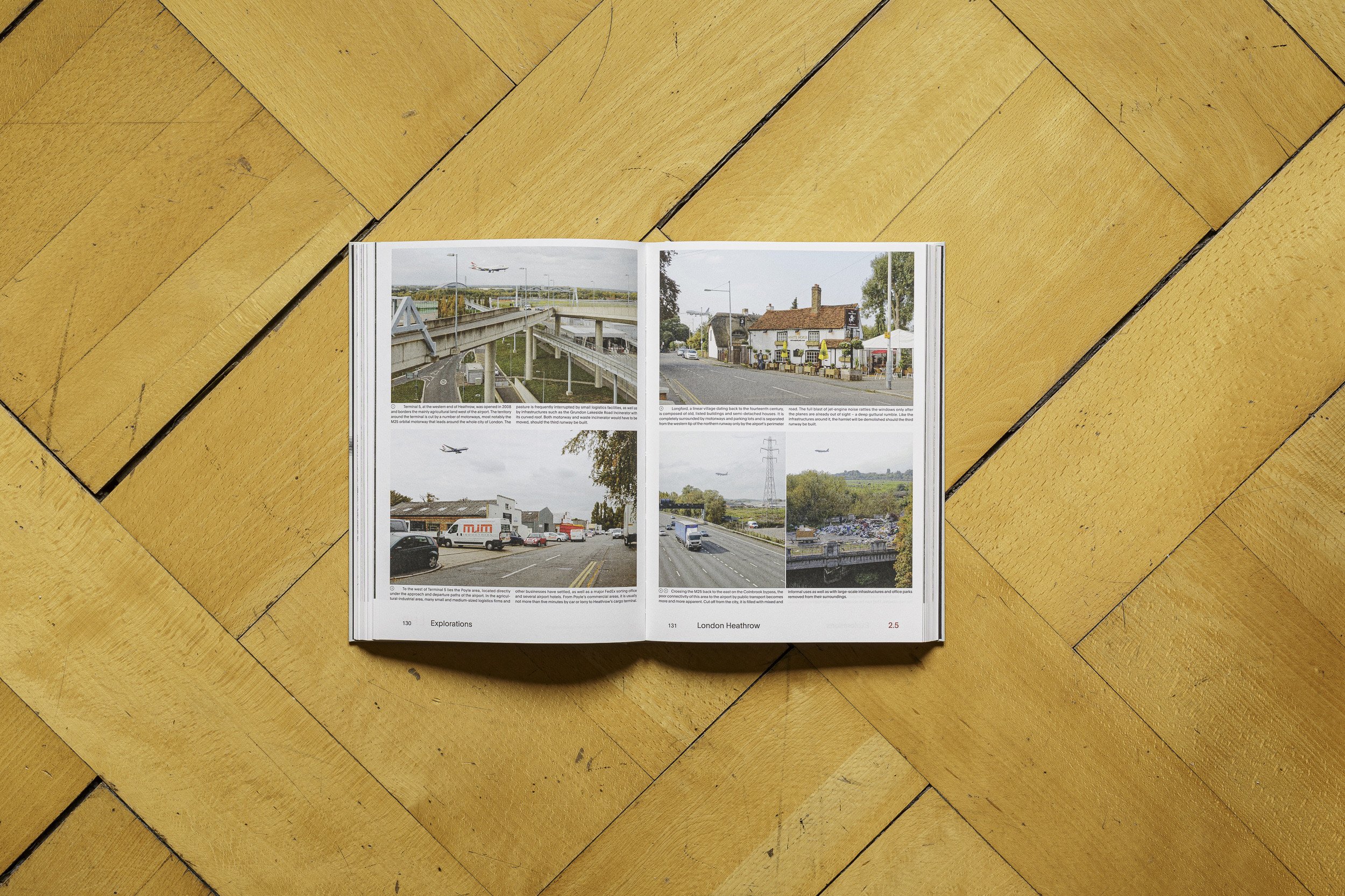
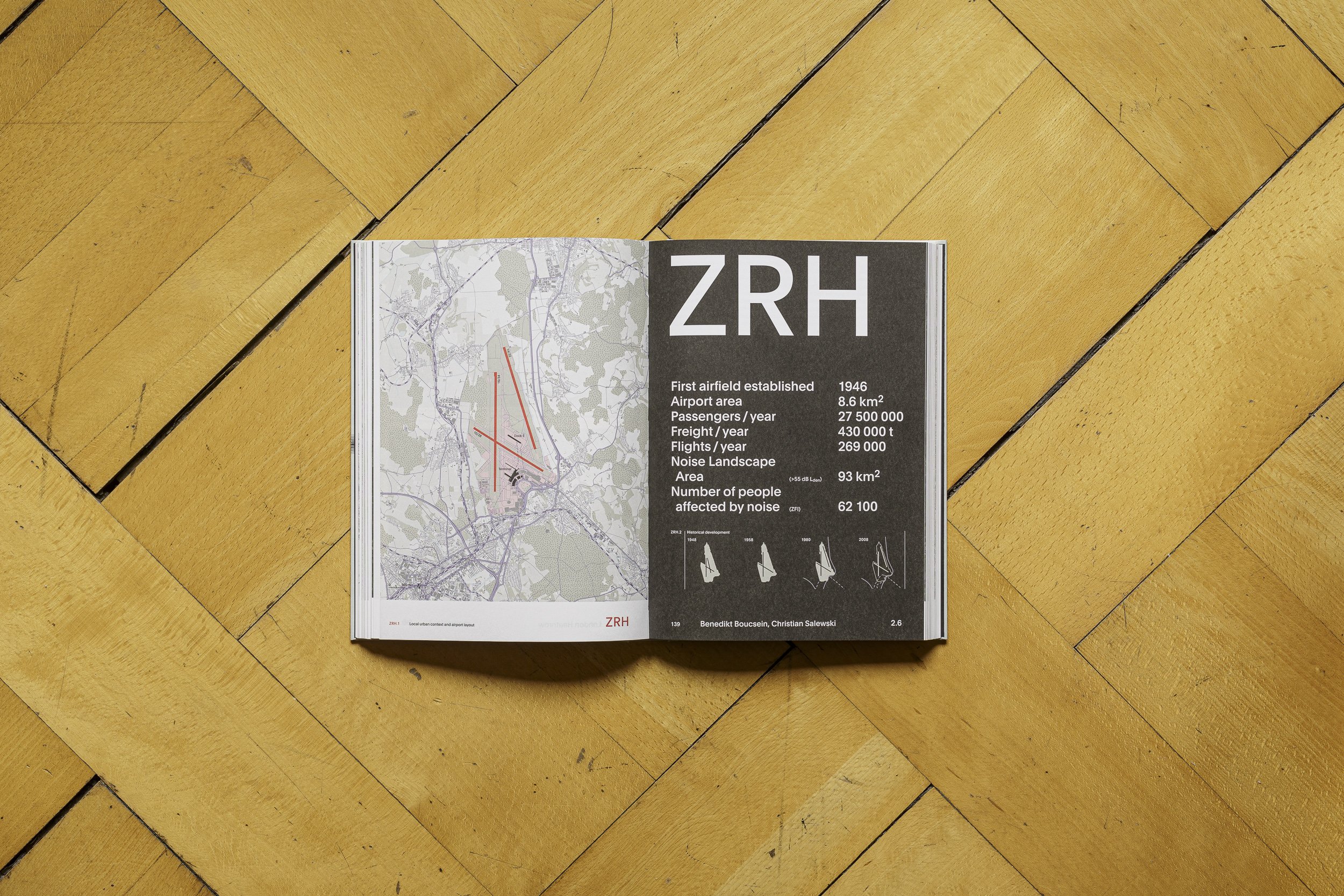
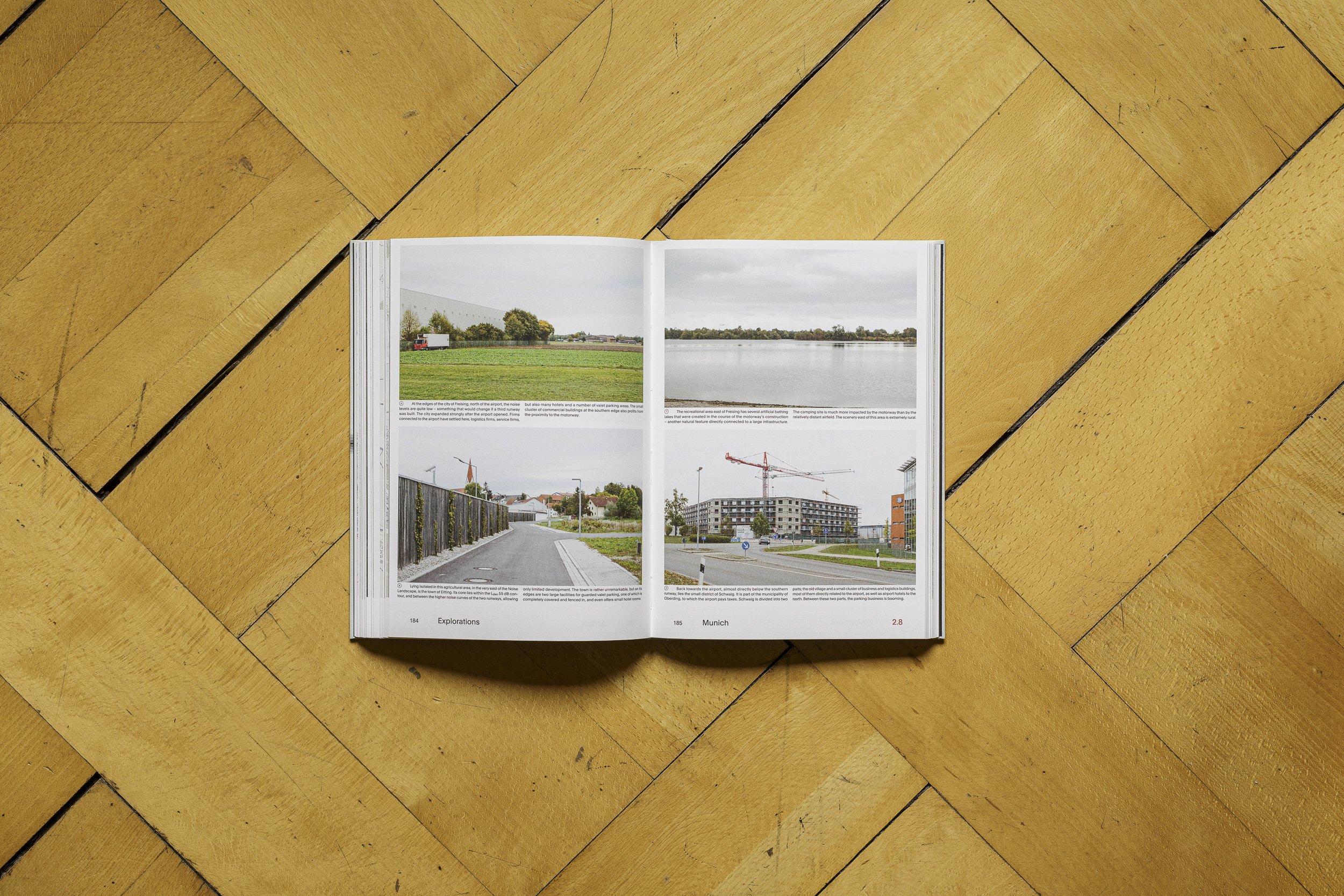
The Noise Landscape
The expansive areas around large airports, affected by noise, infrastructure, and transient forms of architecture, have until now not been researched as a phenomenon.
Publication: The Noise Landscape. A Spatial Exploration of Airports and Cities, Benedikt Boucsein, Kees Christiaanse, Eirini Kasioumi, Christian Salewski, 2017. Graphic design by Studio Joost Grootens.
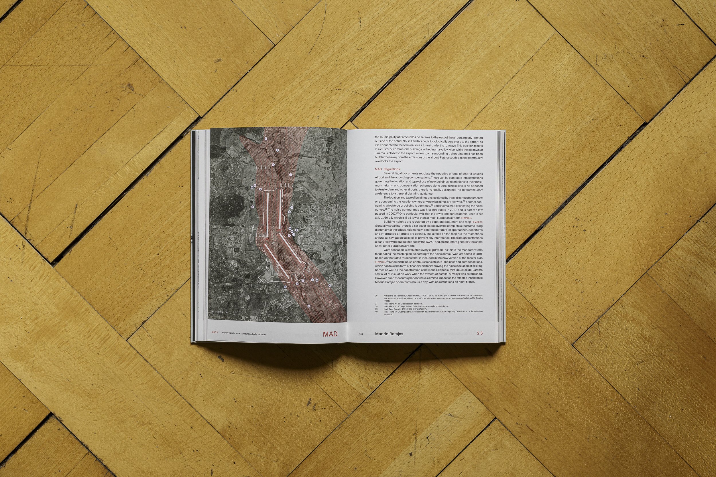
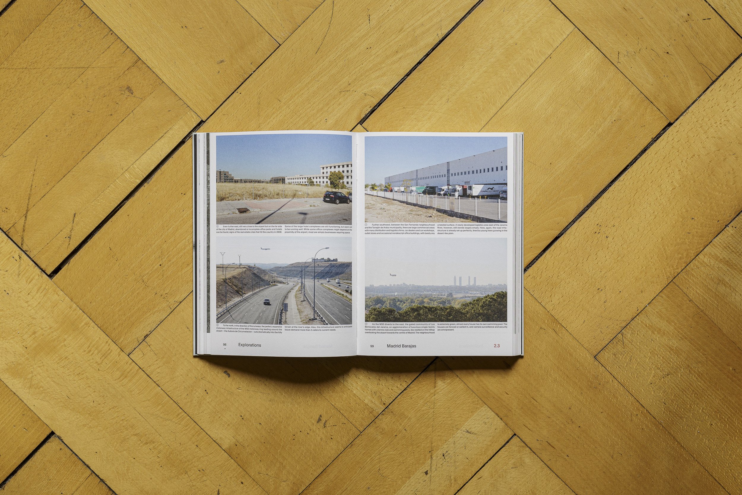
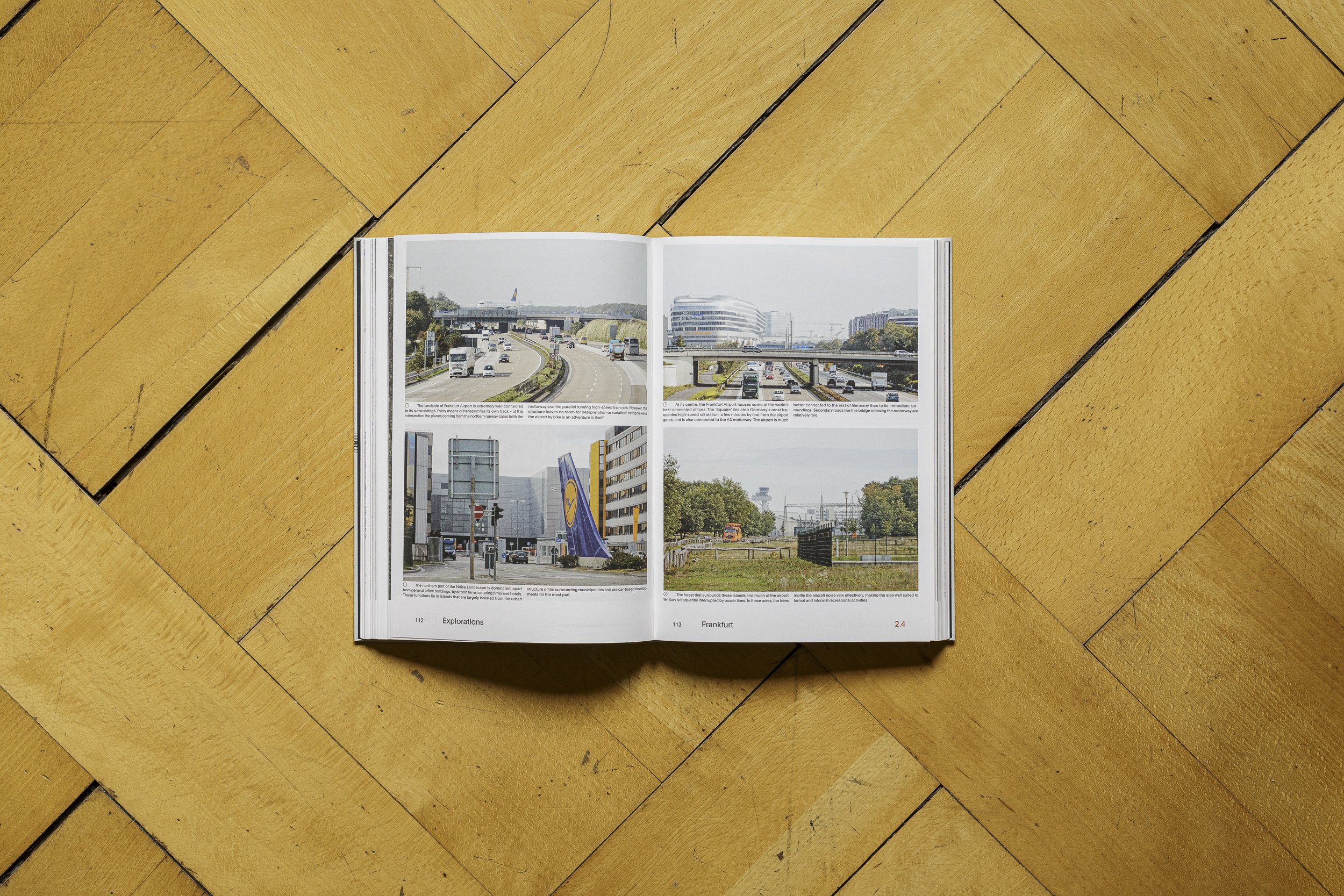
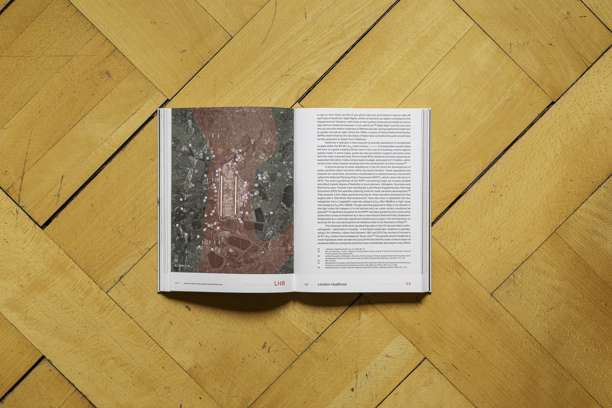
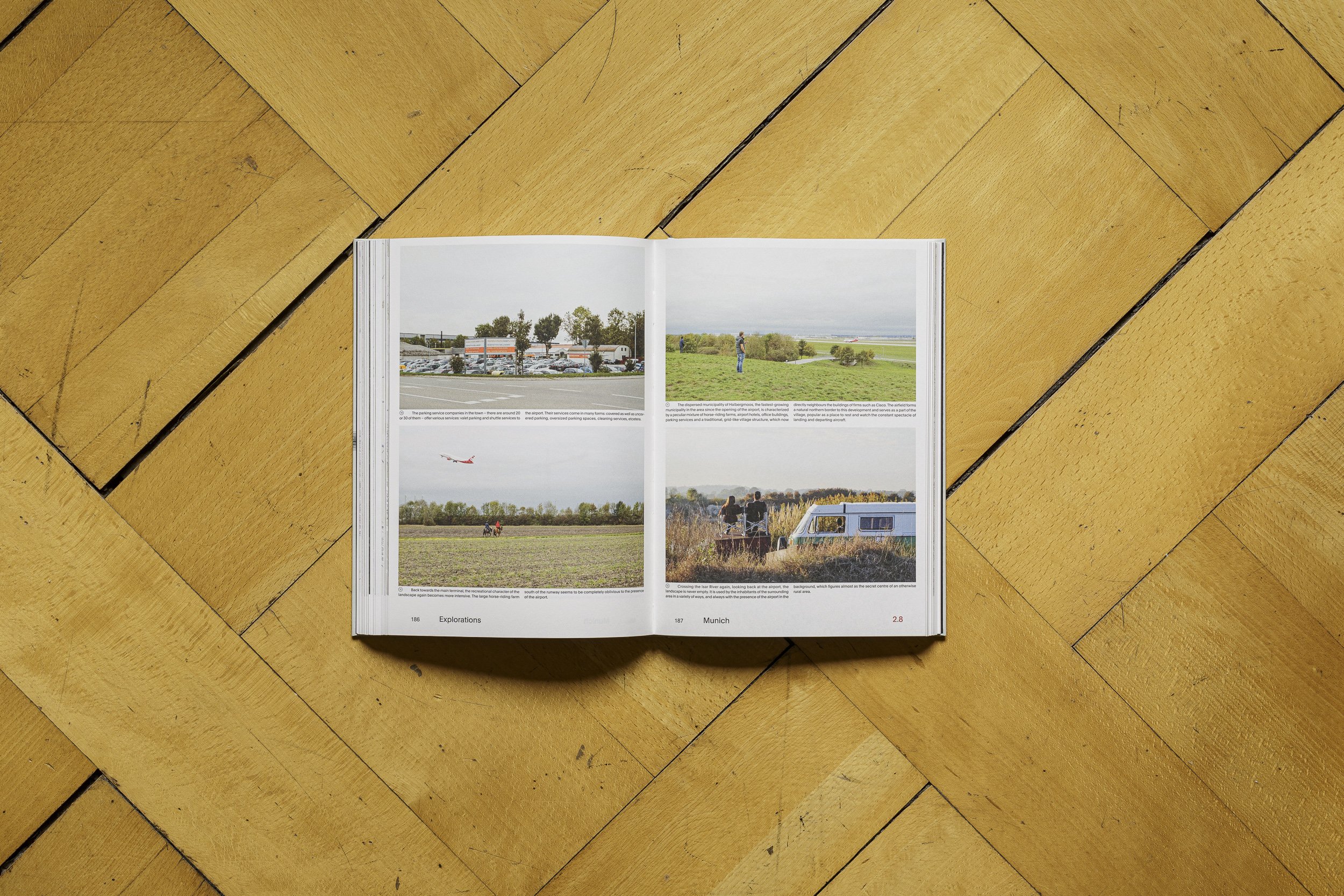
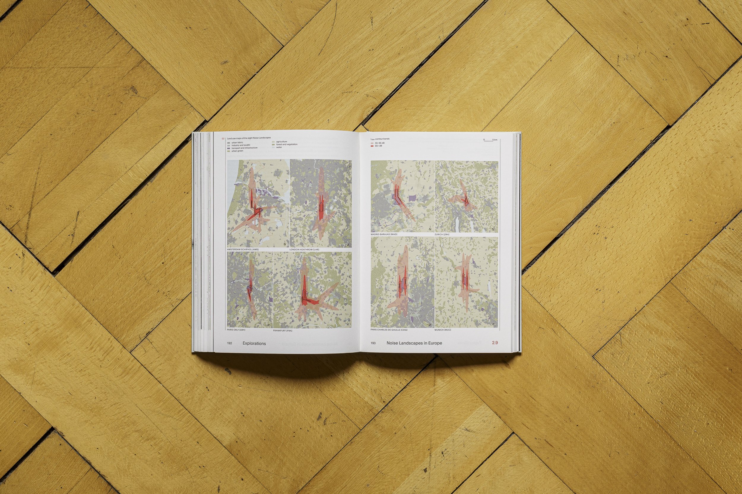
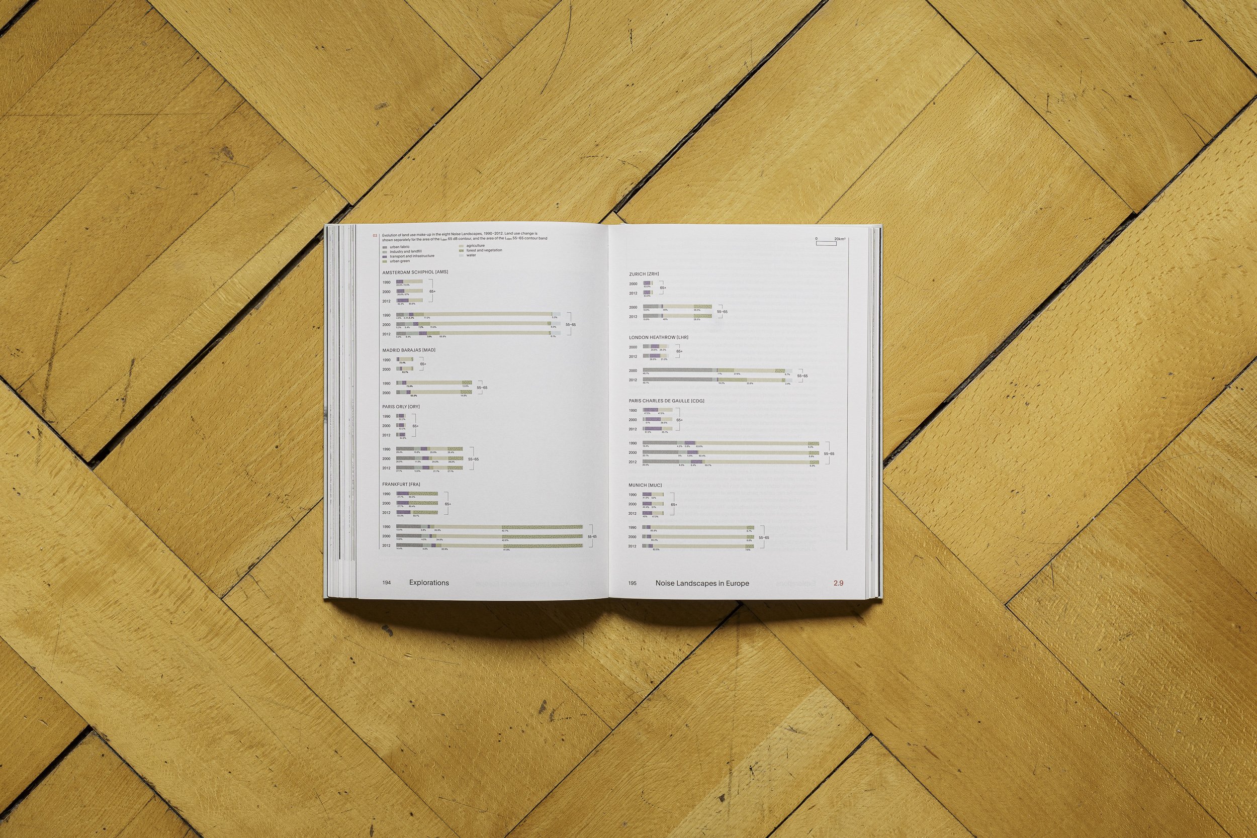
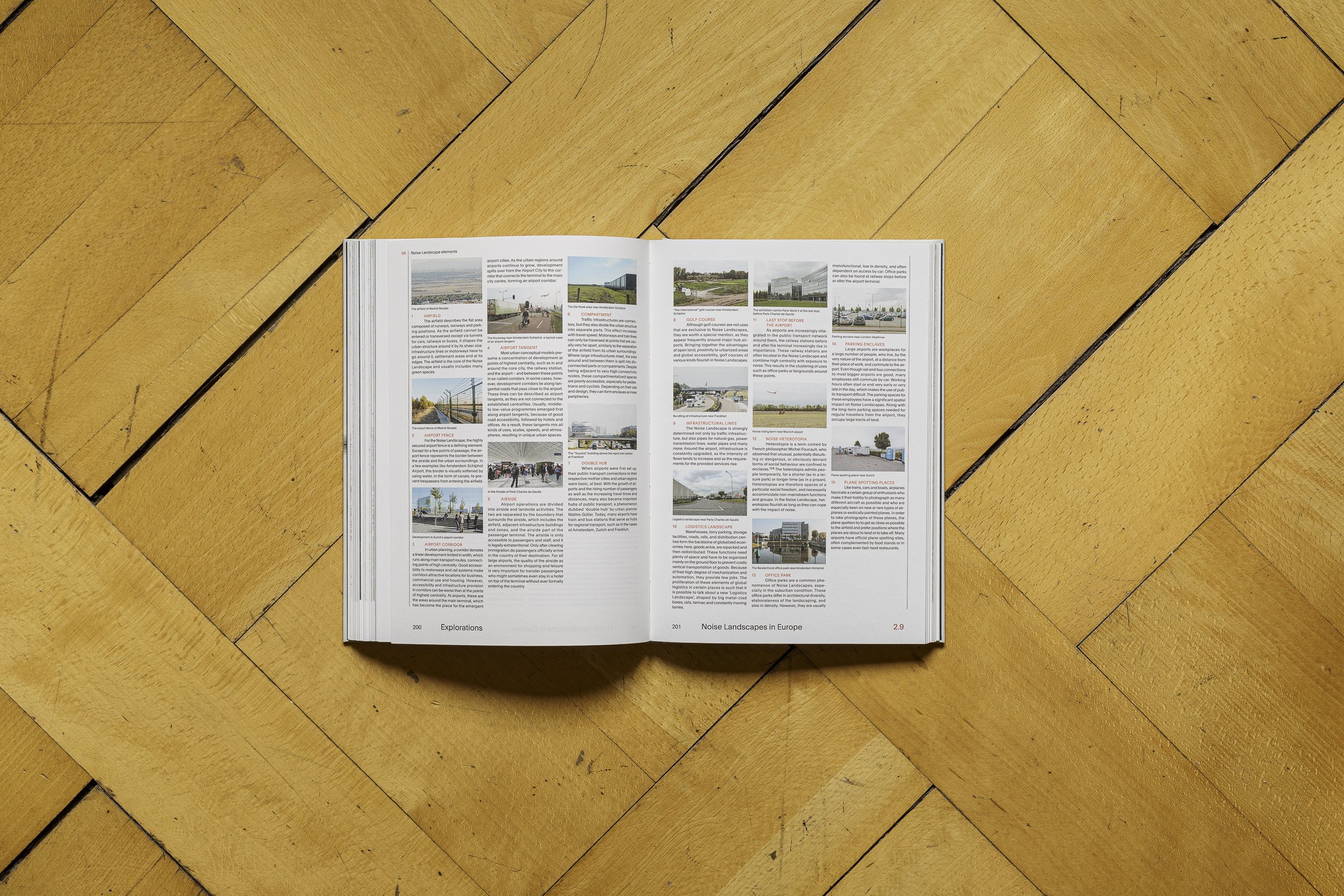
The publication is the outcome of many years of research at Kees Christiaanse’s Chair of Architecture and Urban Design at ETH Zurich. It explores the specificities of the zones around airports in which construction is restricted due to the airplanes’ noise emissions and security measures. I contributed detailed GIS analyses of spatial data, field research of five of the case studies and photo essays of these airports, i. e. Zurich, Munich, Frankfurt, London Heathrow, and Madrid.

Cars and Emperors
Do you remember seeing the arches of the Colosseum in Rome from Piazza Venezia, at the end of the long avenue? This view – it is a fascist view on the ancient monument.
Publication: StoryMap, seminar paper at University of Zurich, 2016.
Do you remember the first time you saw the Colosseum in Rome? How its many arches appeared in the distance, viewed from Piazza Venezia and the marble 'typewriter' monument? Do you remember how you marvelled at Trajan's large column and market on your left, and then the many ruins of the other fora and the Palatine hill on your right? How the Colosseum grew in front of you as you approached it, proudly towering over its surroundings since 2000 years?
You probably did not know, however, that this cinematic view on the Colosseum was actually framed by Benito Mussolini, the fascist dictator. You saw the Colosseum exactly as he wanted you to see it. Before the 1930s, a residential neighbourhood covered most of the Forum area and blocked the view on the Colosseum. Mussolini had it torn down to make space for his triumphal road connecting 'his' Piazza Venezia (remember the iconic balcony) and the Colosseum: the Via dell’ Impero.
With the building of the Via dell' Impero, today called the Via dei Fori Imperiali, Mussolini strove for two aims: making the city car-friendly and showing off its ancient monuments. It was through these two strands that he wanted to build his new city: the Third Rome. Mussolini’s great Rome was supposed to be the third after the ancient Rome of the emperors and the renaissance Rome of the popes. For achieving his goals, Mussolini built schools, post offices, sports facilities, a university campus, a film production city, and a subway—mostly outside the historic centre. The biggest building projects are marked by green circles on the map on the left. Much more than through construction work, however, he shaped the city through demolition. For laying bare the ancient monuments and making the historic centre accessible to the car, he demolished complete neighbourhoods like the one on the Forum Romanum—he even pictured himself as the saviour of Rome, freeing it from its old decadence and burden. For the many pictures showing Mussolini swinging a pickaxe, 'piccone' in Italian, he received his nickname 'picconatore'—he who swings the pickaxe.
In this storymap, I want to show you how Mussolini reframed the ancient monuments of Rome—how Mussolini makes us follow his gaze even today. As you can see on the left, I marked many of the demolitions in red, new fascist buildings in black, and new or widened streets in light blue. Orange lines represent streets planned by Mussolini that have never been executed. As you scroll down, I present to you three places Mussolini transformed and illustrate the changes through historical photographs and up-to-date Street Views: Piazza Navona, the Mausoleum of Augustus and the Forum Romanum. But most importantly, I want you to (re)visit the Eternal City and see and explore it with critical eyes.

Raumakte: Furk’art, oder auch: Furka zum dritten
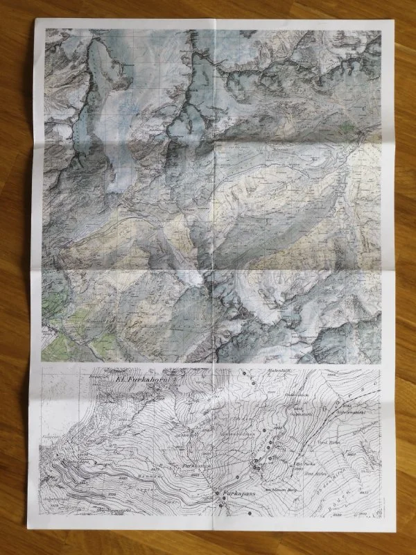
Man sagt ja, die Furka habe ein raues Klima. Die Inschrift jedenfalls lautete VOYAGEZ LEGEREMENT und prangte auf einem der vielen Granitblöcke, die man auf dem Weg zur Sidelenhütte mit Füssen tritt.
Blogpost Raumakte, 2015.

Eine Inschrift in Stein gemeisselt, schon längst wieder vergessen, taucht in einem Blogeintrag über die Furka wieder auf. Kaum zufälligerweise beschreibt die Autorin eine ganz ähnliche Stimmung, ähnliches Wetter. Man sagt ja, die Furka habe ein raues Klima. Die Inschrift jedenfalls lautete VOYAGEZ LEGEREMENT und prangte auf einem der vielen Granitblöcke, die man auf dem Weg zur Sidelenhütte mit Füssen tritt. Das war dann doch sehr erstaunlich. Wer meisselt schon einen Satz in Stein (auf einem Wanderweg!) und dann erst noch eine solche Plattitüde?

Na natürlich Jenny Holzer! Und es war bei weitem nicht der einzige Satz, den sie in Granit hat meisseln lassen (genau, selber war sie wohl noch nie auf dem Pass). Also ein weiteres Mal hoch zur Furka, wenn auch ohne Kletterziel und ohne Jakob. Mit dem Töff geht es zerscht zur Grimsel hoch. Am Abend eines sonnigheissen Tages erwartet uns ein komplett anderes Bild als beim ersten Besuch. Die Furka präsentiert sich nicht wolkenverhangen, düster, kalt und verlassen
//
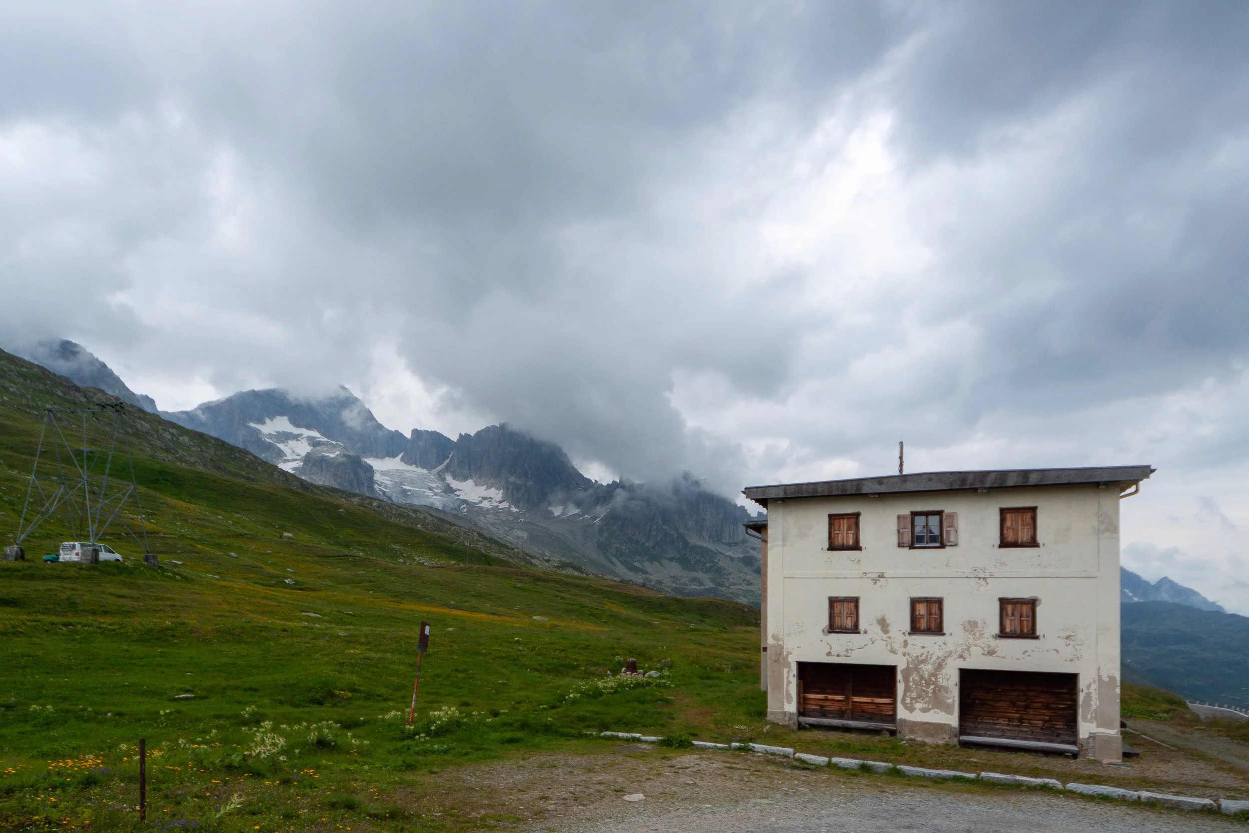
keine einzige Wolke ist am Himmel zu entdecken, es ist freundlich warm, unzählige Campervans stehen auf dem Kiesplatz, wo bis Ende der 80er das Hotel Furka stand. Auf der Strasse herrscht reger Betrieb, eine Imbissbude versorgt die Gäste. ‹Global Soul› prangt gross auf einem alten VW-Bus mit holländischem Nummernschild. Da werden einige Klichées gleichzeitig bedient. Der braune Schnee hat sich fast gänzlich verzogen, saftiges Grün dominiert das Panorama, über den Hängen sind graue Schutthalden zum Vorschein gekommen.
Doch mit der Sonne zieht sich auch die Wärme zurück, die Nacht durchweicht unsere Schlafsäcke und am nächsten Morgen ist der Himmel schon wieder bedeckt. Der Holländer vom Global Soul-Bus nähert sich uns, erkundigt sich nach unseren Lebensläufen und erzählt von seiner eigenen Arbeit: er ist Authentizitätsberater. Er hilft Menschen, ihre Klemmblöcke wiederzufinden, die sie im Lauf der Jahre eingemauert haben hinter Façaden, begraben unter Karrieren, um sie vorsichtig zu lösen und endgültig bergab zu werfen.
Abermals zieht Regen auf. Nichtsdestotrotz mache ich mich auf, Jenny Holzers Inschriften zu suchen. Von den Truisms konnte ich folgende entdecken:
IDENTIFIER SES PEURS RASSURE
ANY SURPLUS IS IMMORAL
YOUR OLDEST FEARS ARE THE WORST ONES
ERFOLG FORDERT OPFER
HUMOR BEFREIT
LA DECENCE EST RELATIVE
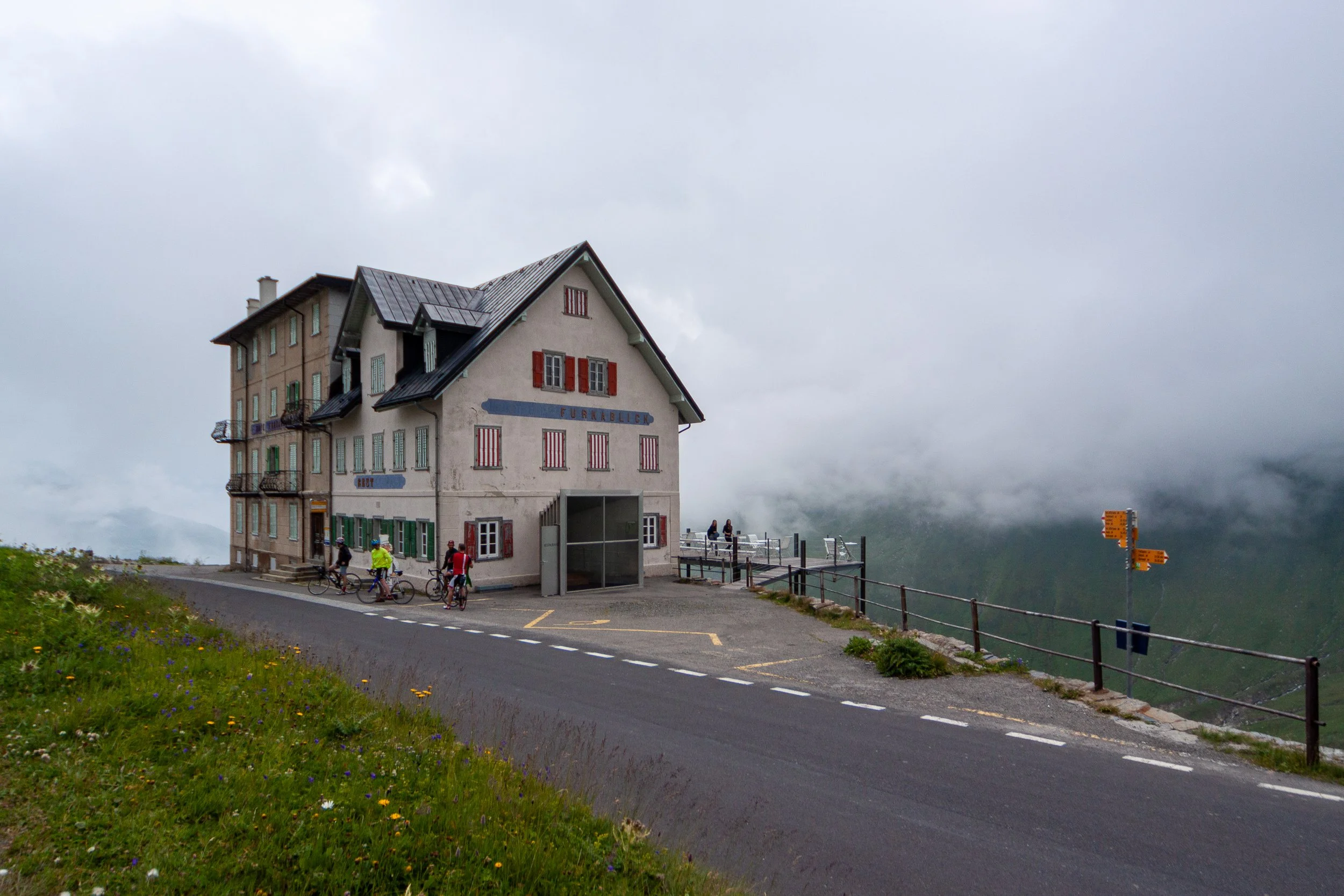
Die Sätze stehen auf Blöcken mitten in der Landschaft. Die meisten Wanderer werden sogar den Reisetipp übersehen, der mitten auf dem Weg prangt; die restlichen Sätze sind auch mit Kenntnis vom Kunstprojekt kaum zu finden. Ausser Holzers Plattitüden sind offenbar überall in der Landschaft weitere Kunstprojekte zu finden, oft jedoch nicht offensichtlich als solche zu entlarven. Vier Betonbalken umschliessen eine Feuerstelle, ein 1,50m hohes Backsteintürmchen geniesst die Aussicht, auf der Dépendance des ehemaligen Hotel Furka sind Pfeile für die Blasrichtung des Windes aufgemalt. Unübersehbar ist hingegen der Windfang des HOTEL RESTAURANT FURKABLICK, über den der Jakob und ich uns amüsiert hatten, sowie das ganze Restaurant mit Terrasse, die von Rem Koolhaas himself entworfen wurden – 1988, noch bevor er gross geworden war.
Die Künstleraktivitäten sind zurückzuführen auf den damaligen Besitzer des Hotels Furkablick, den Galeristen Marc Hostettler, der zwischen 1983 und 1999 Künstler dazu einlud, Projekte rund um den Furkapass zu realisieren. Diese hatten teilweise vergänglichen Charakter – Performances oder Projektionen – andere sind noch immer in der Landschaft zu entdecken. Viele sind jedoch gar nicht erst als Kunst erkennbar (wie die Betonblöcke um die Feuerstelle), andere sind verschwunden oder fast gänzlich verwittert. Im Furkablick ist eine Karte erhältlich, die beim Auffinden der Projekte hilft. Doch kaum jemand scheint sich dafür zu interessieren. Kunst in der Landschaft statt Landschaft als beziehungsweise in Kunst. Oder Kunst als Landschaft? Die Projekte scheinen in der Landschaft verloren gegangen zu sein, verwittert und überwachsen werden sie Teil der Natur. Wie die Archäologen des 3. Jahrtausends die Betonmüllsäcke wohl interpretieren werden?
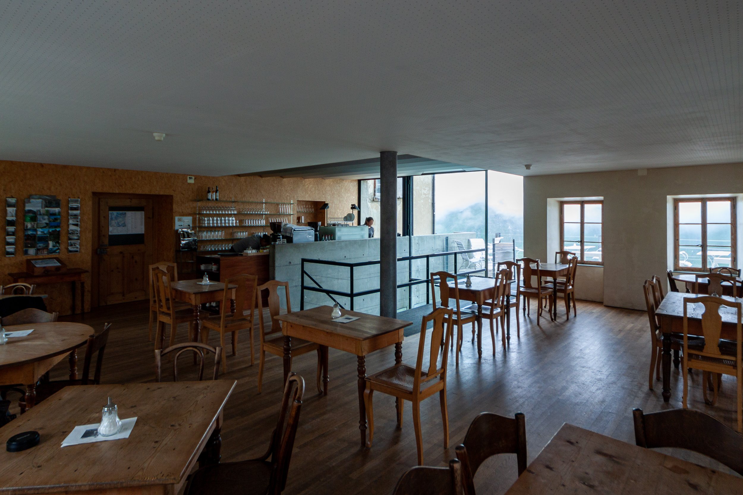
Pünktlich zur Mittagszeit und dem Beginn des etwas verspäteten Regen gibt’s im Furkablick Cappuccino und Kuchen. Dort grüssen die beiden Asiatinnen wieder – sie stammen aus Tibet und sind vor einigen Jahren geflüchtet, um in der Schweiz Asyl zu beantragen. Sie wohnen eigentlich im Kanton St. Gallen, arbeiten jedoch über den Sommer im Furkablick. Die Passstrasse ist ja nur von Juni bis September offen. Ihre zwei Zimmer sind die einzigen bewohnten, das Hotel hat ja offiziell zu. Nach drei Wochen Arbeit stehen ihnen einige Ruhetage zu – wovon sie jeweils einen langen halben Tag hin und retour reisen müssen. Da wunderts einem nicht, dass der Besitzer jedes Jahr Mühe hat, willige Mitarbeiter_innen zu finden. Während eine weder Deutsch noch Englisch spricht, kommuniziert die zweite in einem Kauderwelsch aus Deutsch und Englisch. Seit dem Beginn ihres Deutschkurses verwechsle sie oft Wörter der beiden Sprachen, meint sie lachend. Kundschaft gebe es genug – Autofahrer, Wanderer, Rennvelofahrer, Höhentrainierer, Bergsteiger. Und natürlich Hells Angels. Wobei im Juni schon deutlich weniger los war, müssen sie zugeben. Und im September fällt ja schon wieder der erste Schnee.